Trip Facts
Country:
Nepal
Duration:
14 Days
Max Altitude:
Kang La pass, 5,320 m (17,454 ft)
Activities:
Trekking and a high pass crossing
Region:
Annapurna/Manang region
Starting Point:
Kathmandu
Ending Point:
Kathmandu
Grade:
Strenuous
Group Size:
1 to 12 trekkers
Accomodation:
Teahouses, 3 Star Hotel in Kathmandu
Best Season:
Mar-May & Sep-Nov
Notice
Nar Phu is a restricted area near the Tibet border. By law, you must trek with a licensed guide through a registered agency and carry a special permit. Spade Himalaya arranges every permit for you.
This 14-day trek reaches the hidden Tibetan-Buddhist villages of Phu (4,250 m) and Nar (4,110 m), then crosses the Kang La pass (5,320 m) into Manang. So it suits fit trekkers with some experience.
The valleys are remote, with basic lodges and homestays. So the trek mixes raw mountain wilderness with one of the most authentic Tibetan cultures left in Nepal.
Overview of Nar Phu Valley Trek 14-Days
Quick answer: The Nar Phu Valley Trek is a remote, restricted-area trek in Nepal’s Annapurna region. Over 14 days, it reaches the hidden Tibetan-Buddhist villages of Phu and Nar, then crosses the Kang La pass (5,320 m) into Manang. It needs a special permit and a licensed guide, and it is best in spring and autumn (Nepal Department of Immigration, retrieved 2026-06-30).
The Nar Phu Valley Trek is a 14-day journey into two hidden valleys behind the Annapurna massif. These valleys stayed closed to outsiders until 2003. So they still feel like a piece of old Tibet, lost in time. The people here are of Khampa Tibetan stock. They keep their own dress, language, and Buddhist faith, far from the modern world.
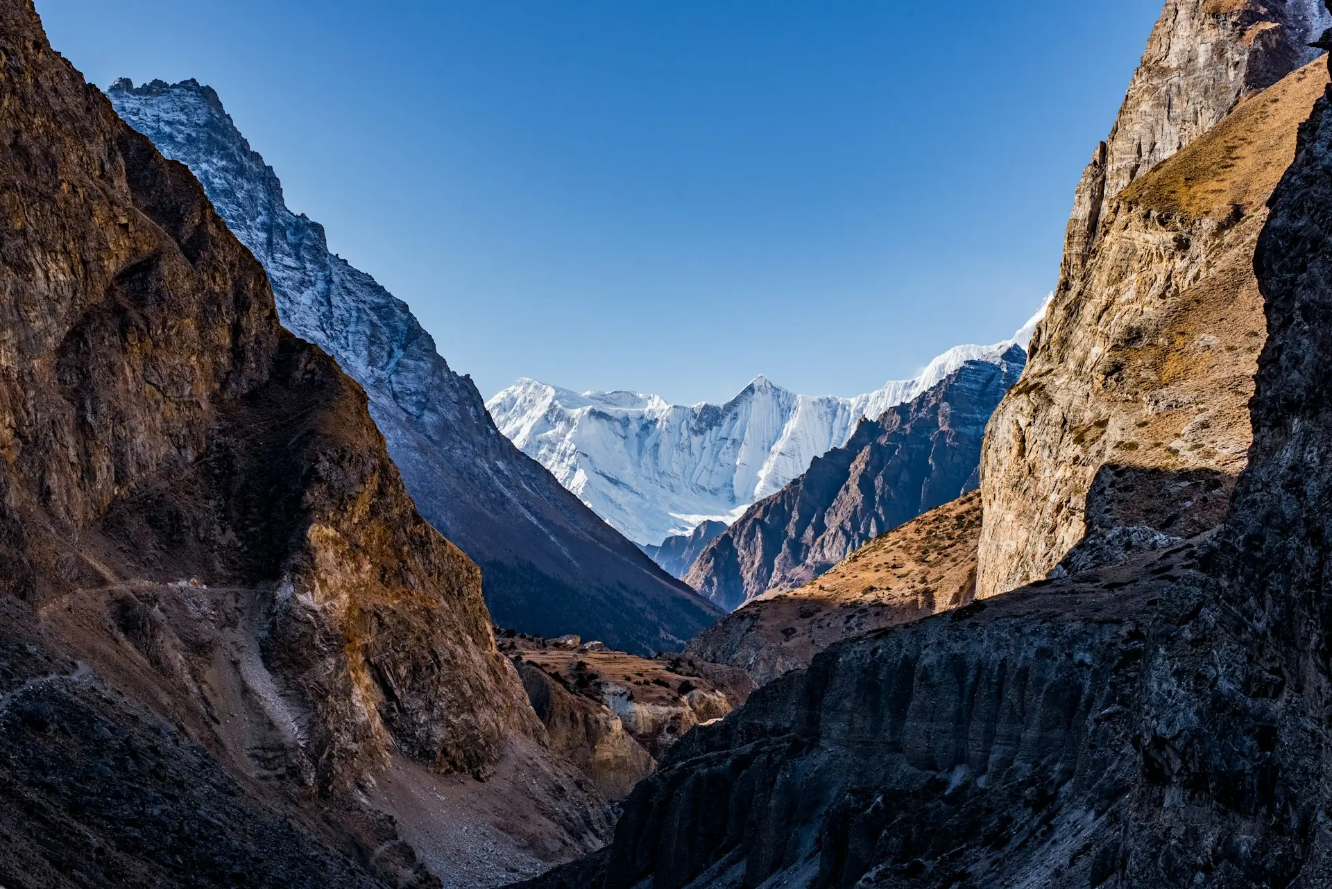
The trek branches off the Annapurna Circuit at Koto. Then it climbs a deep, wild gorge into the Nar and Phu valleys. You reach Phu village (4,250 m), with its old fort-like houses and the ancient Tashi Lhakhang Monastery. After that, you cross to Nar village (4,110 m), a cluster of stone homes draped in prayer flags. The high point is the Kang La pass (5,320 m), which drops you back onto the Annapurna Circuit at Ngawal.
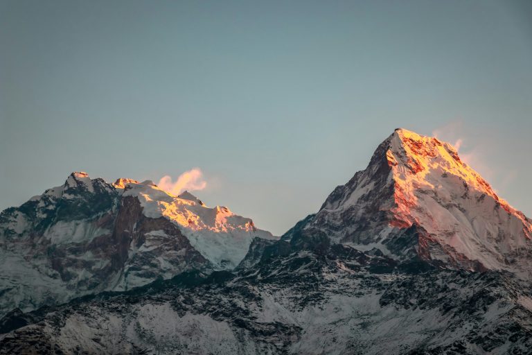
The scenery is raw and huge. You walk below Himlung Himal (7,126 m) and a wall of snow peaks. From the Kang La, you look across to Annapurna II, Gangapurna, and Tilicho Peak. So the trek pairs big mountains with deep, living culture. Yet it sees only a fraction of the crowds on the main circuit.
This trek is graded strenuous. It is remote, it crosses a 5,320 m pass, and the lodges are simple. So you need good fitness and ideally some past trekking at altitude. The plan builds in two days to rest and adjust, at Phu and at Nar. Spade Himalaya runs this trek with licensed Nepali guides. So your guide sets a safe pace, watches the weather, and checks your health each day.
Want a different Annapurna trip? Then see the classic Annapurna Circuit Trek, which Nar Phu joins at Ngawal. You can even add the Annapurna Circuit via Thorong La Pass to cross a second high pass. For another remote, restricted route, see the Manaslu Circuit Trek or the wild Upper Dolpo Trek. For the wider region, read our Annapurna region trekking guide. For this route in detail, from the permits to what the Kang La actually involves, read our Nar Phu Valley trek guide. Because Nar Phu sits in a restricted zone, extra paperwork applies. Our Nepal trekking permits guide explains it in plain language.
Trips Highlights
- Trek the remote, restricted Nar Phu valleys, opened to trekkers only in 2003.
- Visit the medieval Tibetan-Buddhist villages of Phu (4,250 m) and Nar (4,110 m).
- Cross the high Kang La pass (5,320 m) into the Manang valley.
- See the ancient Tashi Lhakhang Monastery near Phu.
- Walk below Himlung Himal (7,126 m) and the peaks of the Annapurna massif.
- Experience a living Tibetan (Khampa) culture, with very few other trekkers.
- Pass deep gorges, fluttering chortens, mani walls, and high yak pastures.
- Look out from the Kang La to Annapurna II, Gangapurna, and Tilicho Peak.
- Finish on the classic Annapurna Circuit at Ngawal and Manang.
- Meet warm highland people in one of Nepal's most isolated corners.
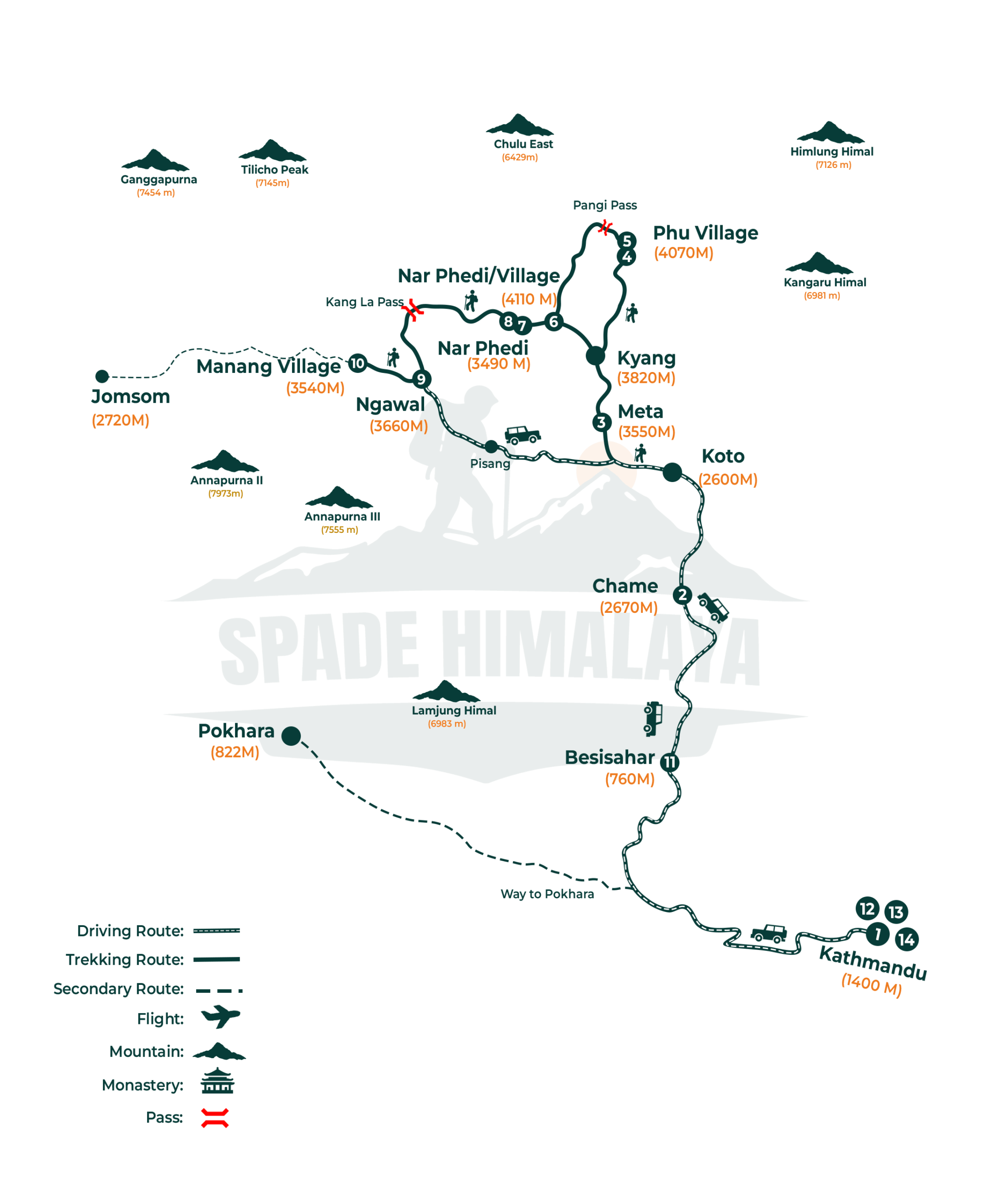
Kathmandu (1,400 m) → drive to Chame (2,670 m) → Koto (2,610 m) → Meta (3,560 m) → Phu village (4,250 m) → Nar Phedi (3,490 m) → Nar village (4,110 m) → Kang La pass (5,320 m) → Ngawal (3,660 m) → Manang (3,540 m) → drive to Besisahar → drive to Kathmandu.
In short, you drive up the Marsyangdi valley to Koto. Then you climb the hidden gorge to Phu and Nar. After that, you cross the Kang La pass to Ngawal and Manang on the Annapurna Circuit. Finally, you drive back down to Besisahar and Kathmandu.
Trips Itinerary
A Spade Himalaya representative meets you at the airport and drives you to your hotel in Thamel, about thirty minutes from the terminal. Nar Phu is a restricted area, so the paperwork matters more here than on an ordinary trek and all of it is done in Kathmandu.
Kathmandu is at 1,400 m, so there is nothing to get used to yet. Your guide runs the briefing in the late afternoon. Bring your passport, several photographs and a copy of your insurance, because Nar Phu is a restricted area and the permit needs all of them.
- Duration: 30 min drive
- Max Altitude: 1,400 m
- Accommodation: Shared 3 star hotel
A long day by private jeep, following the highway west and then turning up the Marsyangdi valley past Jagat and Tal to Chame, roughly 230 km in nine or ten hours.
Chame is at 2,670 m, so you climb more than 1,200 m sitting down. The sealed road ends at Besisahar and everything after that is slow, rough mountain track. Chame is the district headquarters of Manang and has a small hot spring beside the river.
- Duration: 9 to 10 hrs drive (230km)
- Max Altitude: 2,670 m
- Meals: Breakfast, Lunch & Dinner
- Accommodation: Guest House
A short drive to Koto, then the walking starts. You turn north off the Annapurna Circuit into the Nar Phu gorge and climb through pine forest to Meta.
Meta sits at 3,560 m after six or seven hours, so this is a big first day with nearly 1,000 m of gain. Take it slowly and drink more than you think you need.
A checkpoint at Koto inspects your restricted area permit before you can enter. The gorge is narrow, with wooden bridges and waterfalls, and it opens into dry Tibetan country at Meta.
- Duration: 6 to 7 hrs walk
- Max Altitude: 3,560 m
- Meals: Breakfast, Lunch & Dinner
- Accommodation: Guest House
A long and memorable day deep into the valley, crossing high pastures, passing ruined settlements and the summer village of Kyang, and finishing at Phu.
Phu is at 4,250 m and the walk takes seven or eight hours. You drop to the river partway along and climb again, so the day is harder than the height figures suggest.
You walk past rows of chortens, painted mani walls and strange eroded rock pillars. The old stone gateway before the village is hung with prayer flags, and Phu itself sits on a hill like a fort.
- Duration: 7 to 8 hrs walk
- Max Altitude: 4,250 m
- Meals: Breakfast, Lunch & Dinner
- Accommodation: Guest House
You stay a second night in Phu and spend the day exploring the village and the ridge above it, which rests your legs while your body gets used to the height.
The ridge walk goes to around 4,500 m and takes two to four hours, then you come back down to sleep at 4,250 m. It is optional if you would rather stay in the village.
Tashi Lhakhang Monastery above the village is the religious centre of the whole valley and its lama is widely respected here. Himlung Himal and its neighbours fill the skyline from the ridge.
- Duration: 2 to 4 hrs walk
- Max Altitude: 4,500 m
- Meals: Breakfast, Lunch & Dinner
- Accommodation: Guest House
You leave Phu and head for the Nar valley today, retracing part of the gorge downhill with a few short climbs along the way, and finish at Nar Phedi beside the river.
Nar Phedi is at 3,490 m, so you lose around 760 m across six or seven hours. The same ground looks completely different in the morning light coming the other way.
Watch the high slopes for blue sheep, which are common here and are the main prey of the snow leopard. Nar Phedi has a small working nunnery and you can join the evening prayers if you wish.
- Duration: 6 to 7 hrs walk
- Max Altitude: Phu 4,250 m
- Meals: Breakfast, Lunch & Dinner
- Accommodation: Guest House
A short but steep day. The trail climbs out of the river gorge in a series of switchbacks up to the Nar plateau, and most groups are in the village by lunchtime.
Nar is at 4,110 m, which is over 600 m of climbing in about six kilometres, and the shortness of the day is what makes that steepness manageable at this height. Near the top you pass a line of chortens painted red, white and grey, then a long mani wall before the village itself.
- Duration: 3 to 4 hrs walk (6 km)
- Max Altitude: 4,110 m
- Meals: Breakfast, Lunch & Dinner
- Accommodation: Guest House
A second night in Nar, with an easy day spent around the village walking to a viewpoint or one of the gompas, so that you rest properly before the pass tomorrow.
The walking tops out around 4,300 m and takes two or three hours. Nar has several small monasteries holding old statues and painted work, and women here still weave wool and herd yaks much as they always have.
- Duration: 2 to 3 hrs walk
- Max Altitude: 4,300 m
- Meals: Breakfast, Lunch & Dinner
- Accommodation: Guest House
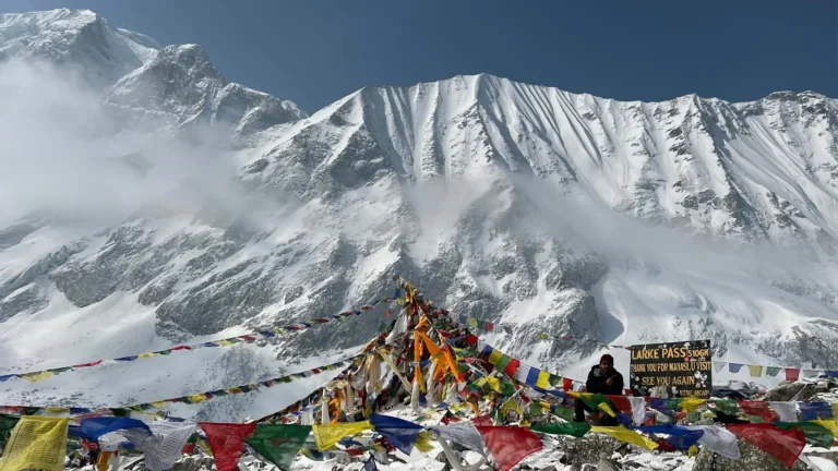
The big day of the trek. You start well before dawn, climb the long rocky slope to the top of the Kang La, then make a steep descent to Ngawal on the far side.
The pass is 5,320 m and Ngawal is at 3,660 m, which means around 1,200 m up and 1,650 m down in seven to nine hours. It is the hardest day of the trek by a distance.
You start that early so that you cross before the wind rises, because the top of the Kang La is completely open ground with nothing at all up there to shelter behind.
From the top you look across to Annapurna II, Gangapurna and Tilicho Peak, with the whole of the Manang valley laid out far below you on the other side of the pass.
- Duration: 7 to 9 hrs hike
- Max Altitude: 5,320 m
- Meals: Breakfast, Lunch & Dinner
- Accommodation: Guest House
An easy day back on the Annapurna Circuit, walking down through the old lanes of Ngawal and across open country to Manang, with time to stop at Braga on the way.
Manang is at 3,540 m, only a little below Ngawal, and the ten kilometres take three or four hours. Braga has a striking monastery built into the hillside, holding old statues and prayer halls worth the detour, and Manang itself is a proper trading village with bakeries and shops.
- Duration: 3 to 4 hrs hike (10 km)
- Max Altitude: 3,660 m
- Meals: Breakfast, Lunch & Dinner
- Accommodation: Guest House
You swap the trail for a jeep today, following the rough road back down the Marsyangdi valley through deep gorges and past tall waterfalls to Besisahar.
Besisahar is at 760 m, so you lose nearly 2,800 m across the 80 km, which takes seven or eight hours because the road is slow and bumpy the whole way. The air turns warm and thick again as you drop, and the terraced farms and green hills of the middle country return.
- Duration: 7 to 8 hrs drive (80 km)
- Max Altitude: 3,540 m
- Meals: Breakfast, Lunch & Dinner
- Accommodation: Guest House
You are back on sealed highway today, following the Marsyangdi and then the Trishuli river through busy hill towns back to Kathmandu, about 175 km in around six hours.
You climb from 760 m back to 1,400 m, and after yesterday this road feels almost luxurious. You reach the city in the afternoon with time to shower and rest, and there is a farewell dinner with the team in the evening.
- Duration: 6 hrs drive (175 km)
- Max Altitude: 1,400 m
- Meals: Breakfast & Lunch Included
- Accommodation: Star Hotel (Shared)
Today is a spare day held in reserve, and it sits in the itinerary because mountain roads and weather in this region genuinely do cause delays for people.
You are back at 1,400 m with nothing that has to happen. Thamel is good for gifts, and the Kathmandu Valley has temples, museums and squares worth a half day. It is also a perfectly reasonable day to do very little at all.
- Max Altitude: 1,400 m
- Meals: Breakfast Included
- Accommodation: Star Hotel (Shared)
Your trip ends today. The morning is free for any last shopping, then a representative drives you to the airport, about thirty minutes from Thamel though traffic can stretch it. You leave with photographs of a valley very few travellers ever reach.
- Max Altitude: 1,400 m
- Meals: Breakfast Included
Trips Include
- All airport transfers in a private vehicle.
- 3 nights' hotel in Kathmandu (3-star, twin share) with breakfast.
- Private jeep transport from Kathmandu to Chame and from Manang to Besisahar to Kathmandu.
- All teahouse and homestay accommodation during the trek.
- All meals (breakfast, lunch, dinner) during the trek, plus a farewell dinner.
- The Nar Phu Restricted Area Permit and the Annapurna Conservation Area Permit (ACAP).
- A licensed, experienced Nepali guide (pay, insurance, meals, lodging).
- Porter support, one porter per two trekkers (pay, insurance, meals, lodging).
- Use of a Spade Himalaya sleeping bag, down jacket, and duffel bag (returned after the trek).
- First-aid kit and a pulse oximeter for daily health checks.
- Trip-completion certificate and all government taxes.
Trips Exclude
- International airfare to and from Nepal.
- Nepal entry visa (US$30 for 15 days, US$50 for 30 days, US$125 for 90 days).
- Lunches and dinners in Kathmandu.
- Kathmandu sightseeing and monument entry fees.
- Travel and medical insurance (mandatory; must cover trekking to 5,500 m and helicopter evacuation).
- All drinks, snacks, hot showers, Wi-Fi, and device charging on the trail.
- Tips for guide, porter, and driver.
- Personal expenses and any costs from early departure or itinerary changes.
- Anything not listed under Cost Includes.
Trips Altitude
Trips Map
Trips Gallery
Packing List
General
- Four-season (zero degree) sleeping bag.
- Sleeping bag liner
- Puffy down jacket.
- Duffel bag.
- Daypack, 35 to 45 litres, with a rain cover
Upper Body
- Knitted hat or beanie
- Buff, scarf, or neck gaiter
- Sunglasses with UV protection
- Headlamp with spare batteries (needed for the pre-dawn pass start)
- Sunscreen (SPF 35 to 60) and lip balm
- Technical base-layer tops (light and heavy)
- Short and long sleeve trekking shirts
- Fleece jacket or wool pullover
- Waterproof, windproof shell jacket
Lower Body
- Technical base-layer trousers
- Hiking trousers (2 pairs)
- Comfortable trousers for the lodges
- Waterproof, windproof shell trousers
Hands
- Wool or technical liner gloves
- Insulated outer gloves for the high pass
Feet
- Waterproof trekking boots (well broken in)
- Warm wool socks and sock liners
- Light shoes or sandals for the evenings
- Micro spikes (useful for snow or ice on the Kang La)
- Gaiters (light for dust, heavier for snow)
Undergarments
- Quick-drying technical underwear
- Sports bras (women)
- Sleeping clothes or pyjamas
First Aid Kits
(Your guide carries a kit, medication, and a pulse oximeter, but a personal kit is strongly recommended.)
- Sunscreen and lip balm
- Antiseptic ointment and blister care
- Personal medication and any altitude medication advised by your doctor
- Water-purification tablets or a UV purifier
- Hand sanitiser and basic cold or stomach medicine
Others
- Passport and several extra passport photos (for the restricted-area permit)
- Reusable water bottle and a hydration bladder
- Toiletry kit, quick-dry towel, toilet paper
- High-protein snacks (bars, nuts)
- Waterproof or dry bags for documents and money
- Trekking poles
Optional
- Power bank and a solar charger (power is scarce in Nar Phu)
- Camera or phone for photos
- Binoculars
- Cards or a book
- Thermos for hot water
Good to Know
Nar Phu is one of the last truly hidden corners of Nepal. It opened to trekkers only in 2003, so it sees very few visitors. So you walk among medieval Tibetan villages, old monasteries, and raw mountain scenery. The Kang La pass then links you back to the famous Annapurna Circuit. In short, it is a rare mix of deep culture and high adventure.
Nar Phu is a restricted area, so the rules are strict. By law, you must trek with a licensed guide from a registered agency, and you carry a special permit. In March 2026, Nepal began letting a single traveller apply for the permit. Still, the guide and the agency are required. So Spade Himalaya, as a registered agency, handles every permit and rule for you.
You reach the trek by a long jeep ride, not by air. The drive from Kathmandu to Chame takes 9 to 10 hours on rough mountain roads. The return from Manang is just as bumpy. So a little patience helps, and the spare day at the end protects your flight home. The scenery on these drives is dramatic, with gorges and waterfalls.
The plan follows the climb-high, sleep-low rule. So it adds rest days at Phu and Nar before the Kang La. Drink 3 to 4 litres of water a day, and walk slowly. Skip alcohol up high, and eat well for energy. If you feel unwell, tell your guide at once. Going down is the best cure, and your guide carries an oximeter.
The trail runs on cash, and there are no ATMs in Nar Phu. So carry enough Nepalese rupees from Kathmandu. Mobile signal and Wi-Fi are very limited in the valleys. Power is scarce too, often from small solar panels. So bring a power bank and a solar charger, and enjoy the deep quiet of the hills.
Trips Reviews
No reviews found.
Trips FAQs
Permits, Guide & Insurance
Yes. Nar Phu is a restricted area, so you need a special Restricted Area Permit, plus the Annapurna Conservation Area Permit (Nepal Department of Immigration, retrieved 2026-06-30). The Nar Phu permit costs about US$100 per person per week from September to November, and about US$75 per week from December to August. Spade Himalaya arranges both permits for you.
Yes. As a restricted area, Nar Phu requires a licensed guide and a registered agency by law. In March 2026, Nepal began letting solo travellers apply for a restricted-area permit, but the guide and agency are still required (Kathmandu Post, 2026). So Spade Himalaya gives you a licensed Nepali guide and handles the paperwork.
Yes, it is a must. Your policy has to cover trekking to 5,500 m and a helicopter rescue. Many normal policies do not, so check the wording first. Nar Phu is remote, so good cover matters even more here. Arrange it at home before you fly, and leave a copy with Spade Himalaya at the briefing.
Trek Difficulty & Altitude
It is graded strenuous. You walk 3 to 9 hours a day, and you cross the Kang La pass at 5,320 m. The valleys are remote, and the lodges are basic. There is no technical climbing. Still, the altitude, the long days, and the high pass make it demanding. So you need good fitness and ideally some past trekking at altitude.
This plan is 14 days from Kathmandu to Kathmandu. That includes the drives, the trek, and a spare day at the end. So you get two days to rest and adjust, at Phu and at Nar. We can also shorten or extend the trek to fit your time.
The Kang La pass is 5,320 m (17,454 ft), the high point of the trek. You cross it on Day 9, on a long day from Nar to Ngawal. From the top, you see Annapurna II, Gangapurna, and Tilicho Peak. So the plan adds two rest days first, at Phu and Nar, to help you adjust.
It is a real risk, because you cross 5,320 m and sleep above 4,000 m for several nights. So the plan climbs slowly and adds two rest days. Your guide checks your oxygen with a pulse oximeter each day. Drink 3 to 4 litres of water daily, walk slowly, and tell your guide early if you feel unwell. Going down is the best cure.
Best Time to Trek
Spring (March to May) and autumn (late September to November) are best, with clear skies and stable weather. The Kang La needs a clear, snow-free window, so flexibility helps. Winter is very cold, and the pass can be blocked by snow. The summer monsoon is drier here than in the rest of Nepal, but the access roads can wash out.
Accommodation & Facilities
The lodges in Nar and Phu are basic, with simple twin rooms and shared toilets. In Nar Phedi, you may stay at the monastery guesthouse. So the comfort is lower than on the main trails. The food is simple but filling: dal bhat, noodles, potatoes, soup, and Tibetan bread. So bring some snacks of your own for the high days.