Trip Facts
Country:
Nepal
Duration:
15 Days
Max Altitude:
4984 m Tserko Ri
Activities:
Trekking and driving
Region:
Langtang Region
Starting Point:
Kathmandu
Ending Point:
Kathmandu
Grade:
moderate to strenuous
Group Size:
Min 2
Accomodation:
Teahouses, Hotel in Kathmandu
Best Season:
Mar-May & Sep-Nov
Notice
Route update, 2 September 2026. This trek is currently running on a longer alternative route. The glacial flood of 26 August destroyed the road through Syabrubesi, so the standard itinerary below cannot run for now. Instead we are running a 16 day route that walks in and out from Sundarijal and avoids the damaged road completely. It reaches the same places, Gosaikunda, Langtang village and Kyanjin Gompa, but on foot in both directions.
Alternative route, 16 days, in outline:
- Day 1: Arrival in Kathmandu
- Day 2: Kathmandu to Sundarijal, trek to Chisapani (2,300 m)
- Day 3: Chisapani to Kutumsang (2,470 m)
- Day 4: Kutumsang to Ghopte (3,440 m)
- Day 5: Ghopte to Gosaikunda (4,380 m) via Laurebina Pass (4,610 m)
- Day 6: Gosaikunda to Thulo Syabru (2,120 m)
- Day 7: Thulo Syabru to Lama Hotel (2,470 m)
- Day 8: Lama Hotel to Langtang Village (3,430 m)
- Day 9: Langtang Village to Kyanjin Gompa (3,800 m)
- Day 10: Rest day at Kyanjin Gompa, optional Kyanjin Ri (4,850 m)
- Day 11: Kyanjin Gompa to Lama Hotel (2,470 m)
- Day 12: Lama Hotel to Chandanbari (3,300 m)
- Day 13: Chandanbari to Ghopte / Phedi (3,440 m)
- Day 14: Ghopte to Kutumsang (2,470 m)
- Day 15: Kutumsang to Chisapani (2,300 m)
- Day 16: Chisapani to Sundarijal, drive to Kathmandu
This is a longer and more demanding trip than the standard itinerary, and the price is different. Send us your dates and we will come back with the full day by day detail and a quote. The standard itinerary below is unchanged and returns as soon as road access is restored.
This trek joins two highlights into one trip: the Langtang Valley and the sacred Gosaikunda Lake (4,380 m). It then crosses Laurebina La pass (4,610 m) into the Helambu region.
The high point of the route is Laurebina La (4,610 m). The optional Tserko Ri hike from Kyanjin Gompa reaches 4,984 m, the highest point you can stand on.
The whole trek lies inside Langtang National Park, north of Kathmandu. So a licensed guide and permits are required. Spade Himalaya arranges your guide, the park permit, and the TIMS card.
Overview of Langtang Gosaikunda Trek 15-Days
Quick answer: The Langtang Gosaikunda Trek is a 15-day, moderate-to-strenuous trek combining the Langtang Valley, the sacred Gosaikunda Lake (4,380 m), and Laurebina La pass (4,610 m). It needs no flight from Kathmandu, plus a park permit, a TIMS card, and a guide (Nepal Tourism Board, retrieved 2026-06-26).
The Langtang Gosaikunda Trek is a 15-day journey through the Langtang region, north of Kathmandu. It blends three things in one trip: a high mountain valley, a sacred lake, and a quiet pass crossing. It runs inside Langtang National Park, Nepal’s first Himalayan national park, set up in 1976. So you get big peaks, deep forest, and warm Tamang culture, close to the capital.
The trek starts with a drive to Syabrubesi (1,460 m). Then you climb the Langtang Valley through forest to Kyanjin Gompa (3,870 m). Here you find an old monastery and a famous yak-cheese factory. From the village, you can hike to Tserko Ri (4,984 m) or Kyanjin Ri (4,773 m) for a huge view of Langtang Lirung (7,234 m) and the range.
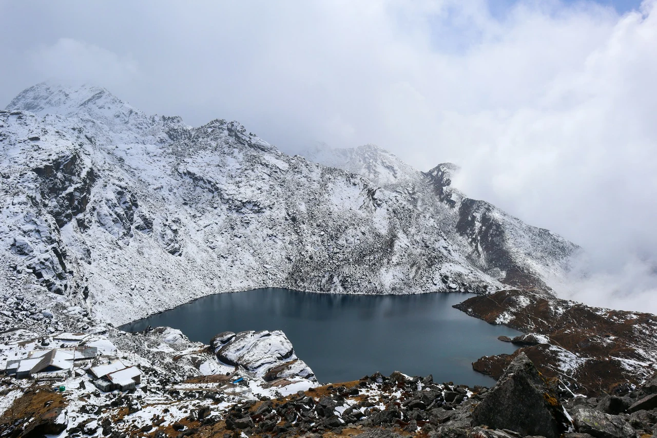
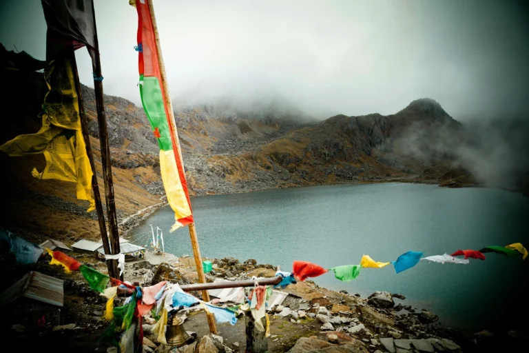
After the valley, you trek south to the sacred Gosaikunda Lake (4,380 m). This turquoise lake is holy to both Hindus and Buddhists, and pilgrims come here in large numbers each year. The next day, you cross Laurebina La pass (4,610 m), the highest point on the route. From the pass, you see Manaslu and Ganesh Himal across the valleys. Then you descend into the green Helambu region and finish near Sundarijal, on the edge of Kathmandu.
This trek is graded moderate to strenuous. The days are long, you cross a high pass, and you spend several nights above 3,000 m. So you need a good level of fitness. But there is no technical climbing. With a slow pace and an acclimatization day at Kyanjin Gompa, it is within reach of most fit trekkers.
Spade Himalaya runs this trek with licensed Nepali guides. So your guide sets a safe pace, watches the weather, and checks your health each day. Want a shorter trip in the same area? See the Langtang Valley Trek, which visits Kyanjin Gompa and Tserko Ri without the Gosaikunda crossing. For the easiest trek in the region, try the Helambu Trek. For other regions, try the Everest Base Camp Trek, the Annapurna Base Camp Trek, or the remote Manaslu Circuit Trek.
Still weighing it up? Our Gosaikunda Lake Trek cost guide breaks down every expense. The guide to Gosaikunda Trek difficulty and best time shows how hard it is and when to go. Not sure which route suits you? Then read Langtang Valley vs Gosaikunda. For everything in one place, see our Langtang region trekking guide.
Trips Highlights
- Climb the Langtang Valley to Kyanjin Gompa (3,870 m) and its yak-cheese factory.
- Hike Tserko Ri (4,984 m) or Kyanjin Ri (4,773 m) for a 360-degree mountain view.
- See Langtang Lirung (7,234 m) and the Langtang range up close.
- Reach the sacred Gosaikunda Lake (4,380 m), holy to Hindus and Buddhists.
- Cross Laurebina La pass (4,610 m), the high point of the trek.
- Descend into the quiet Helambu region, far from the crowds.
- Walk through Langtang National Park, Nepal's first Himalayan national park.
- Meet warm Tamang and Sherpa villagers and visit old monasteries.
- Spot wildlife like red panda, langur monkeys, and Himalayan tahr.
- Finish near Sundarijal, on the edge of the Kathmandu Valley.
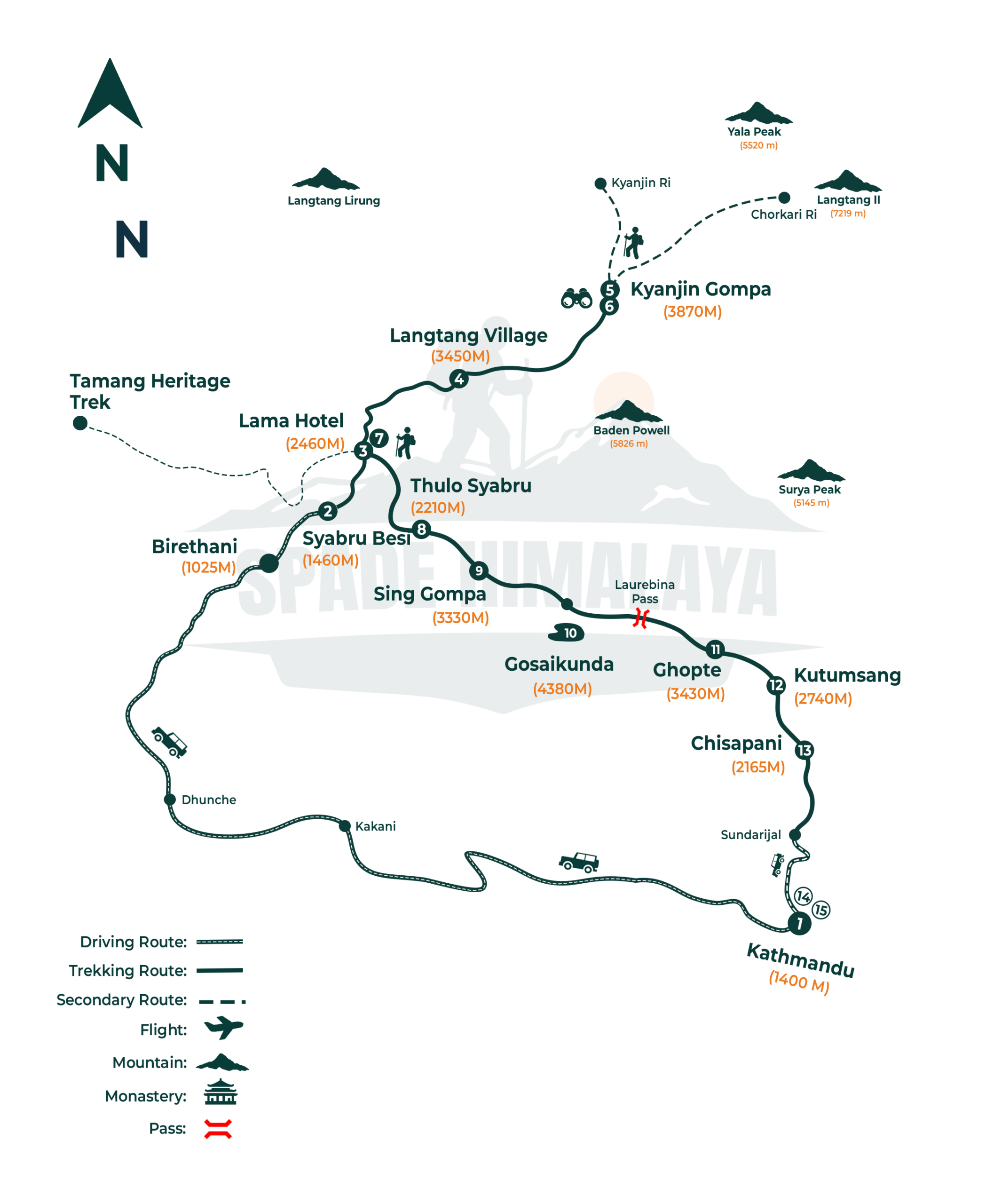
Kathmandu (1,400 m) → drive to Syabrubesi (1,460 m) → Lama Hotel (2,460 m) → Langtang Village (3,450 m) → Kyanjin Gompa (3,870 m) → Tserko Ri (4,984 m) or Kyanjin Ri → back to Lama Hotel → Thulo Syabru (2,250 m) → Sing Gompa (3,330 m) → Gosaikunda (4,380 m) → Laurebina La pass (4,610 m), Ghopte (3,430 m) → Kutumsang (2,470 m) → Chisapani (2,165 m) → Sundarijal (1,460 m), drive to Kathmandu.
In short, you climb the Langtang Valley to Kyanjin Gompa, then return and head south to Gosaikunda Lake. After that, you cross Laurebina La pass into Helambu and walk out through Kutumsang and Chisapani to Sundarijal, near Kathmandu.
Trips Itinerary
A Spade Himalaya representative meets you at the airport and drives you into Thamel, about thirty minutes away. Langtang is the closest of the big trekking regions to the capital, and you reach it tomorrow by road rather than by any flight at all.
Kathmandu is at 1,400 m, so there is no altitude to manage yet. In the evening your guide runs the briefing, explains the route and the safety plan and checks your gear. Bring your passport, photographs and a copy of your insurance for the permits.
- Duration: 30 min Drive
- Max Altitude: 1,400 m
- Accommodation: Shared 3 Star Hotel
A long drive north out of Kathmandu, climbing through green hills and terraced farmland and then following the Trishuli river gorge the whole way to Syabrubesi.
Syabrubesi is at 1,460 m and the drive takes seven or eight hours. The road is rough in places and slow throughout, so it is a full day rather than a morning transfer. Ganesh Himal and the Langtang range come into view on the clear stretches.
- Duration: 7 to 8 hrs Drive
- Max Altitude: 1,460 m
- Meals: Breakfast, Lunch & Dinner Included
- Accommodation: Guest House
The walking begins today. You cross the Bhote Koshi on a suspension bridge and then climb steadily beside the Langtang river through thick forest for most of the day.
Lama Hotel is at 2,460 m after six or seven hours, so you gain around 1,000 m. The climb is steady rather than brutal but it is a long first day on the feet.
The forest here is oak, bamboo and rhododendron, and langur monkeys and birds are common in it. You pass Guru Rinpoche Gompa on the way, and Lama Hotel is a cluster of lodges rather than a village.
- Duration: 6 to 7 hrs hike
- Max Altitude: 2,460 m
- Meals: Breakfast, Lunch & Dinner Included
- Accommodation: Guest House
The trail keeps climbing and the forest thins out as you go, opening into riverside meadows and finally reaching the rebuilt settlement of Langtang Village.
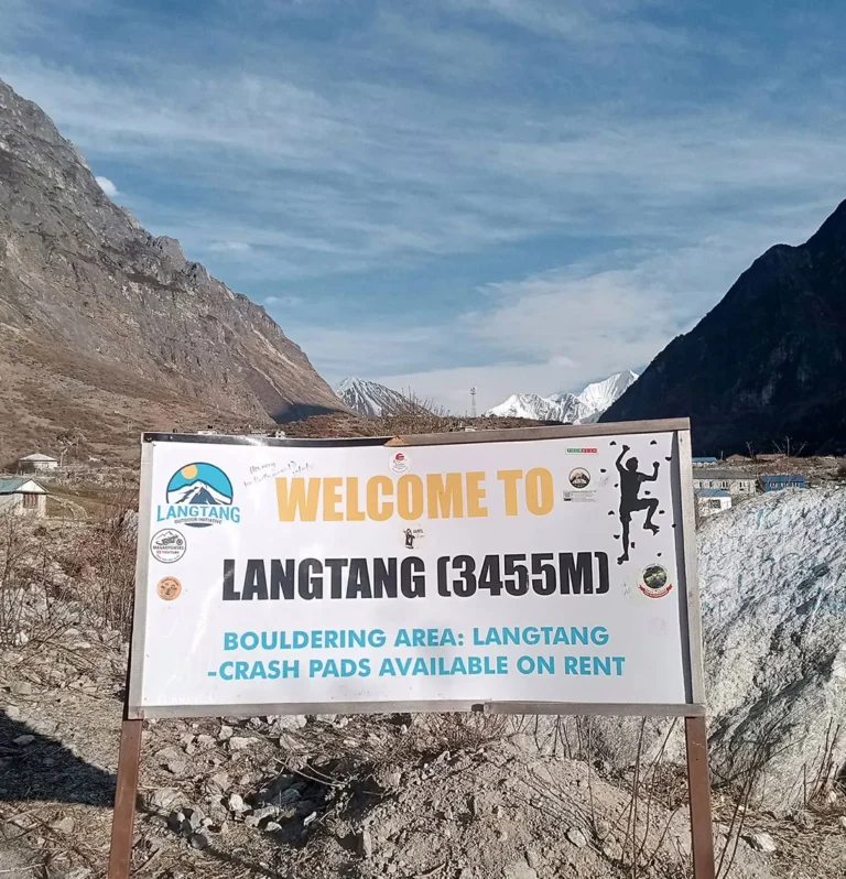
Langtang Village sits at 3,450 m, so today is close to 1,000 m of gain across five or six hours. This is where altitude starts to matter, so drink plenty and say if you feel unwell.
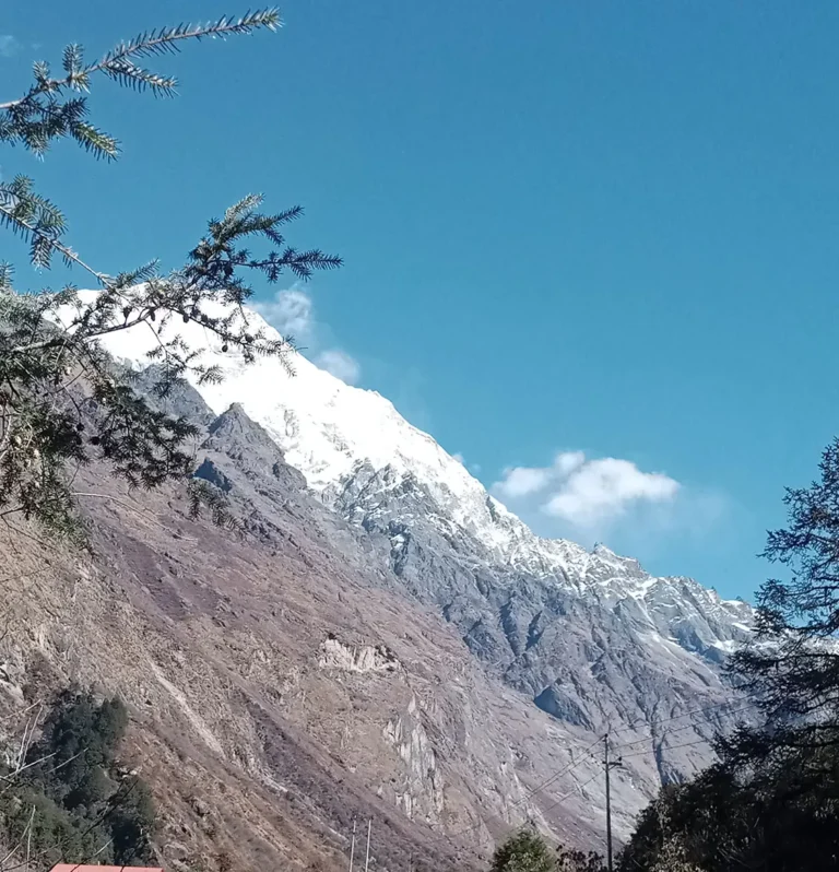
Langtang Lirung at 7,234 m is the highest peak in the region and stands above you here. The village was destroyed by the 2015 earthquake and has been rebuilt, so staying here supports the community.
- Duration: 5 to 6 hrs hike
- Max Altitude: 3,450 m
- Meals: Breakfast, Lunch & Dinner Included
- Accommodation: Guest House
A deliberately short day of three or four hours follows the river gently upstream past mani walls and chortens to Kyanjin Gompa at the head of the valley.
Kyanjin Gompa is at 3,870 m, only around 420 m above the village. The short stage gives your body the afternoon to catch up with the height you gained yesterday.
You pass the small settlements of Mundu and Sindum on the way in. The dairy here makes yak cheese that is worth trying, and the old monastery that names the place sits below the glaciers.
- Duration: 3 to 4 hrs hike
- Max Altitude: 3,870 m
- Meals: Breakfast, Lunch & Dinner Included
- Accommodation: Guest House
A second night at Kyanjin Gompa with a hard hike to get you used to the height, climbing either Tserko Ri or the shorter Kyanjin Ri and returning to the village to sleep.
Tserko Ri is 4,984 m, around two to three hours of steep climbing each way. Kyanjin Ri at 4,773 m is the gentler option and still gives you most of the view.
From the top you look across the whole Langtang range, with Dorje Lakpa away to the east and the glacier running out below you toward the Tibetan border.
It is a hard morning at this height, and it is the best viewpoint of the whole trek, so pick your option honestly and then start early whichever one you choose.
- Duration: 5 to 6 hrs hike
- Max Altitude: 4,984 m
- Meals: Breakfast, Lunch & Dinner Included
- Accommodation: Guest House
You turn around today and retrace the valley, following the Langtang river back down through the villages you passed on the way up and into the forest to Lama Hotel.
You lose over 1,400 m across five or six hours. Downhill is easier on the lungs and harder on the knees, so poles earn their place today. The valley looks different walking the other way and things you missed on the climb up tend to show themselves now.
- Duration: 5 to 6 hrs
- Max Altitude: 3,870 m
- Meals: Breakfast, Lunch & Dinner Included
- Accommodation: Guest House
You leave the Langtang valley behind and turn toward Gosaikunda, walking through pine forest and small villages on a trail with plenty of ups and downs.
Thulo Syabru is at 2,250 m after six or seven hours. The net height change is small but the profile is broken, so the day is more work than the figures suggest. It is a Tamang village strung along a ridge, with long views down the valley from the lodges.
- Duration: 6 to 7 hrs hike
- Max Altitude: 2,460 m
- Meals: Breakfast, Lunch & Dinner Included
- Accommodation: Guest House
A steady climbing day through pine and rhododendron forest brings you up to the small settlement of Sing Gompa, which people in this area also call Chandanbari.
Sing Gompa is at 3,330 m, so you gain around 1,080 m across five or six hours. The air is noticeably thinner and colder by the time you arrive in the afternoon.
The settlement has a monastery and a cheese factory, and both are open to visitors. The Langtang range gets closer with every hour of the climb, so stop and look back often.
- Duration: 5 to 6 hrs hike
- Max Altitude: 3,330 m
- Meals: Breakfast, Lunch & Dinner Included
- Accommodation: Guest House
Today you reach the sacred lakes. The trail climbs through the last of the forest, opens into high rocky country at Laurebina, and finally reaches Gosaikunda.
Gosaikunda sits at 4,380 m, so this is around 1,050 m of climbing across five or six hours. It is high ground and the pace needs to be slow the whole way up.
Manaslu and Ganesh Himal open up behind you as you climb, and the lake itself is a deep turquoise, set in bare rock with almost nothing growing around it.
Gosaikunda is holy to Hindus and Buddhists alike, and tens of thousands come here on pilgrimage every August for the Janai Purnima festival at the full moon.
- Duration: 5 to 6 hrs hike
- Max Altitude: 4,380 m
- Meals: Breakfast, Lunch & Dinner Included
- Accommodation: Guest House
The hardest day of the trek. You climb steeply from the lake up to the Laurebina La, the highest point of the whole route, then make a long descent down to Ghopte.
The pass is 4,610 m and Ghopte is at 3,430 m, which makes seven or eight hours of walking. That is a short climb and then a very long way down over rough ground.
From the top you look back across the lakes and out over the ranges in every direction. The descent runs through boulder fields and high meadows, so take it carefully on tired legs.
- Duration: 7 to 8 hrs hike
- Max Altitude: 4,610 m
- Meals: Breakfast, Lunch & Dinner Included
- Accommodation: Guest House
You climb to Tharepati and then drop into the green Helambu region, descending through rhododendron forest and a string of small villages to Kutumsang.
Tharepati is at 3,690 m and Kutumsang at 2,470 m, six or seven hours in total. You climb first and then lose more than 1,200 m, with the steepest part near Mangengoth.
From Tharepati you can see Gangchempo and Dorje Lakpa, and a side trail heads off on the Helambu Circuit if you have extra days. You cross Kyuola Bhanjyang just before the village.
- Duration: 6 to 7 hrs hike
- Max Altitude: 3,690 m
- Meals: Breakfast, Lunch & Dinner Included
- Accommodation: Guest House
A rolling day through green hills and farming villages, walking the dusty ridge road by way of Chipling and then Pati Bhanjyang to reach Chisapani in the afternoon.
Chisapani is at 2,165 m and the day takes six or seven hours. The ground goes up and down all day rather than dropping steadily, which is tiring in its own way, and the ridge gives wide views over the valleys on both sides for most of the walk.
- Duration: 6 to 7 hrs hike
- Max Altitude: 2,470 m
- Meals: Breakfast, Lunch & Dinner Included
- Accommodation: Guest House
The last walking day drops through the forests of Shivapuri Nagarjun National Park to Sundarijal, where a vehicle is waiting to drive you into Kathmandu.
You drop to 1,460 m across four or five hours, then drive about an hour into the city. Much of the descent is on stone steps, so save something for your knees. You finish beside the reservoir that supplies much of Kathmandu, and the afternoon is free.
- Duration: 4 to 5 hrs walking & driving
- Max Altitude: 1,460 m
- Meals: Breakfast & Lunch Included
- Accommodation: Shared 3 Star Hotel
Your trip ends today. After a relaxed breakfast a representative collects you and drives you to the airport, about thirty minutes away though traffic can stretch it. You leave with the high valley, a sacred lake and a hard pass behind you.
- Meals: Breakfast Included
Trips Include
- All airport transfers in a private vehicle.
- 2 nights' hotel in Kathmandu (3-star, twin share) with breakfast.
- Kathmandu to Syabrubesi by local bus (trek start).
- Private car or van from Sundarijal back to Kathmandu (trek end).
- All teahouse and lodge accommodation during the trek.
- All meals (breakfast, lunch, dinner) during the trek, plus a farewell dinner.
- Safe drinking water using a filter or purification tablets.
- Langtang National Park entry permit and TIMS card.
- A licensed, first-aid trained, English-speaking Spade Himalaya guide (2 guides for groups over 12).
- Porter support, one porter per two trekkers (pay, insurance, meals, lodging, equipment).
- First-aid kit for daily health checks.
- Rescue-operation assistance for serious illness (funded by your travel insurance).
Trips Exclude
- International airfare and airport departure tax.
- Nepal entry visa (US$30 for 15 Days, US$50 for 30 days, US$125 for 90 days).
- Lunches and dinners in Kathmandu.
- Kathmandu sightseeing, private car, guide, and monument entry fees (about US$26).
- Travel and medical insurance (mandatory; must cover high-altitude trekking and helicopter evacuation).
- All drinks, snacks, hot showers, Wi-Fi, and device charging on the trail.
- Tips for guide, porter, and driver.
- Extra nights in Kathmandu from early arrival, late departure, or itinerary changes.
- Personal trekking gear and any personal expenses.
- Anything not listed under Cost Includes.
Trips Altitude
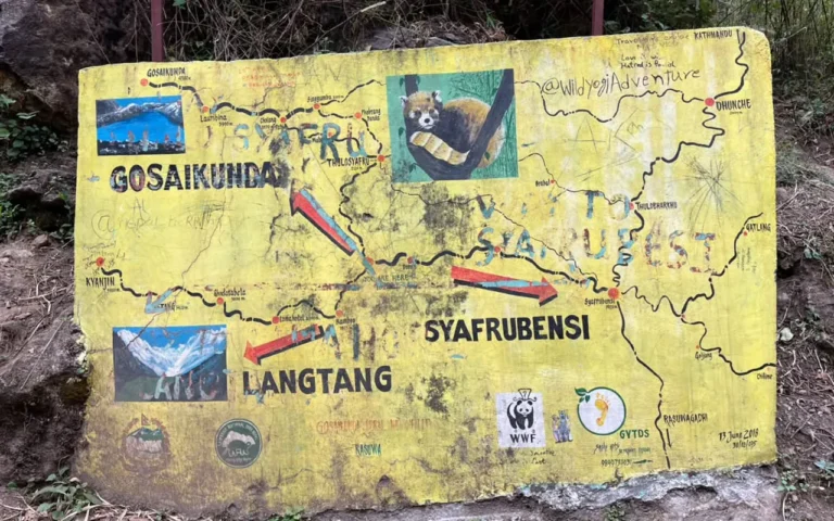
Trips Map
Trips Gallery

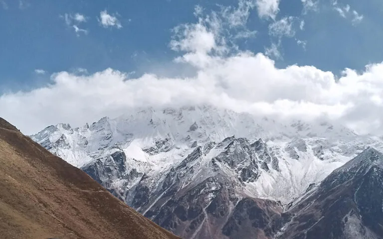
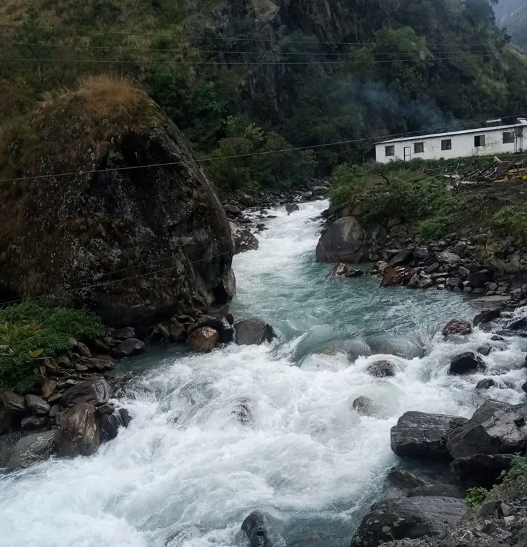
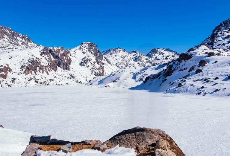
Packing List
General
- Four-season (zero degree) sleeping bag, rated to about minus 10°C
- Sleeping bag liner
- Puffy down jacket
- Duffel bag
- Daypack, 30 to 40 litres, with a rain cover
Upper Body
- Warm hat or beanie that covers the ears
- Neck gaiter, buff, or scarf
- Sunglasses with UV protection
- Headlamp with spare batteries
- Sunscreen (SPF 50) and lip balm
- Moisture-wicking base-layer tops
- Fleece jacket or wool pullover
- Waterproof, windproof shell jacket
Lower Body
- Thermal base-layer trousers
- Comfortable trekking trousers
- Light trousers for the teahouses
- Waterproof, windproof shell trousers
Hands
- Wool or technical liner gloves
- Warm outer gloves for the pass and the high hike
Feet
- Waterproof trekking boots with ankle support (well broken in)
- 4 to 5 pairs of warm wool socks and sock liners
- Light shoes or sandals for the evenings
- Micro spikes if there is snow on the pass or Tserko Ri
Undergarments
- Quick-drying technical underwear
- Sports bras (women)
- Thermal underwear set for cold nights
First Aid Kits
(Your guide carries a kit, medication, and a pulse oximeter, but a personal kit is strongly recommended.)
- Assorted adhesive and blister bandages
- Antiseptic ointment and pain relief (ibuprofen or paracetamol)
- Altitude medication such as acetazolamide (Diamox), only if advised by your doctor
- Anti-itch ointment
- Water-purification tablets
Others
- Passport, passport photos, and a copy of your insurance
- Reusable water bottle and a water filter or purifier
- Toiletry kit, quick-dry towel, toilet paper, hand sanitiser
- High-energy snacks (bars, nuts, dried fruit)
- Waterproof or dry bags for documents and electronics
Optional
- Trekking poles (your own, if you prefer them; otherwise provided)
- Power bank and spare batteries (power is scarce up high)
- Camera with memory cards, charger, and spare batteries
- Local SIM card for the lower trail
- Gaiters for dust, and a book or cards for the evenings
Good to Know
This trek packs three experiences into one. You get the Langtang Valley, the sacred Gosaikunda Lake, and a high pass into Helambu. So you see big peaks, a holy lake, and quiet villages in a single trip. It is also close to Kathmandu, with no flight needed. Best of all, your visit supports a region that has rebuilt with great spirit since the 2015 earthquake.
Spring and autumn are the prime seasons. In spring, the forests bloom red and pink, and you may spot red panda or musk deer. In autumn, the air is clear after the rains, so the mountain views are at their best. Winter is harsh up high, with snow and a risk of a blocked pass. The summer monsoon brings rain and leeches, so most trekkers avoid it.
This trek is moderate to strenuous, and it is long. So train before you come. Build your stamina with regular cardio, like walking, jogging, or cycling. Also strengthen your legs for the steep climbs. A few practice hikes with a daypack help a lot. The fitter you are, the more you will enjoy the high days and the pass.
The plan climbs slowly and adds a rest day at Kyanjin Gompa. So your body has time to adjust before the pass. Drink 3 to 4 litres of water a day, and walk at an easy pace. Skip alcohol up high, and eat well for energy. Tell your guide early if you feel a headache or nausea. In rare, severe cases, altitude sickness can be dangerous, so your guide watches closely and will descend with you if needed.
The trek runs through Langtang National Park, so foreigners must trek with a licensed guide. You need the park permit and a TIMS card, plus a small Shivapuri park fee for the Helambu exit. Spade Himalaya is a registered agency, so the guide and permits are all handled for you. You only need your passport, photos, and insurance copy.
You sleep in family-run teahouses. Lower down, some have private bathrooms. Higher up, the rooms are basic and warmed by a stove in the dining hall. The food is fresh and filling, with dal bhat, momo, thukpa, and Western dishes at bigger lodges. For water, refill and purify rather than buy bottles. This saves money and cuts plastic waste in the park.
The trail runs on cash, and there are no ATMs. So carry enough Nepalese rupees from Kathmandu. Hot showers, Wi-Fi, and charging all cost a small fee that rises with altitude. There is no flight on this trek. You drive in to Syabrubesi and walk out to Sundarijal, near Kathmandu. So it is simple and affordable to reach.
Trips Reviews
One of the Most Rewarding Treks I Have Ever Done in Nepal
Perfect Mix of Adventure, Nature, and Local Culture
An Incredible Journey Through Valleys, Lakes, and High Passes
Trips FAQs
Trek Difficulty & Altitude
It is graded moderate to strenuous. The Langtang Gosaikunda trek difficulty comes from the length, the high pass, and the many nights above 3,000 m. You walk 5 to 8 hours a day on clear but sometimes steep trails. The high point is Laurebina La pass at 4,610 m. There is no technical climbing. So fit trekkers who train first and pace themselves can complete it well.
The highest point on the route is Laurebina La pass at 4,610 m, crossed on Day 11. Gosaikunda Lake sits at 4,380 m. The optional Tserko Ri hike from Kyanjin Gompa reaches 4,984 m, the highest point you can stand on. So the plan adds an acclimatization day at Kyanjin Gompa and climbs slowly to keep you safe.
It is a real risk, since you cross 4,610 m and sleep many nights above 3,000 m. So the plan climbs slowly and adds an acclimatization day at Kyanjin Gompa. Drink 3 to 4 litres of water a day, walk slowly, and skip alcohol up high. Your guide carries an oximeter and checks you daily. Tell them early if you feel unwell. Going down is the best cure.
Trek Highlights & Views
Gosaikunda is a sacred alpine lake at 4,380 m. It is holy to both Hindus and Buddhists. By legend, Lord Shiva created the lake. Each year, many pilgrims visit, especially during the Janai Purnima festival in summer. So the lake is both a natural and a spiritual highlight of the trek.
Permits, Guide & Insurance
Yes. The trek runs through Langtang National Park, so foreigners must trek with a licensed guide. You also need two permits: the Langtang National Park entry permit and a TIMS card. The Helambu exit also passes through Shivapuri Nagarjun National Park, which has its own small fee. Spade Himalaya arranges the guide and all the permits.
The Langtang National Park permit is about NPR 3,000 (around US$25) for foreign trekkers. The TIMS card is about NPR 2,000 (around US$15). So the main permits total roughly US$40 per person, plus a small Shivapuri park fee at the end. Spade Himalaya includes these in the trip cost and handles the paperwork.
Yes, it is a must. Your policy has to cover high-altitude trekking and a helicopter rescue. Many normal policies do not, so check the wording first. Arrange it at home before you fly. Then leave a copy with Spade Himalaya at the briefing, so the team can act fast in an emergency.
Best Time to Trek
Spring (March to May) and autumn (late September to November) are best. In spring, the rhododendron forests bloom and the air is mild. In autumn, the skies are clear and the views are sharp. Winter brings heavy snow up high, and the pass can be blocked, so it is risky. The summer monsoon brings rain, leeches, and cloud, so most people skip it.
Accommodation & Facilities
You sleep in simple teahouses, usually in twin rooms with shared bathrooms. Higher up, rooms are basic and cold. The food is hearty and varied. Dal bhat (rice and lentils) is the staple, with free refills. You can also get momo, thukpa, noodles, soup, and even pizza or sandwiches at bigger lodges. Vegetarian meals are easy to find.
Some teahouses offer Wi-Fi and charging for a small fee, but both get patchy higher up. Power can be solar in remote spots, so charge when you can. There are no ATMs on the trail. So carry enough Nepalese rupees in cash from Kathmandu for snacks, drinks, charging, and tips.