Trip Facts
Country:
Tsum Valley, Manaslu region, Gorkha district, Nepal
Duration:
15 Days
Max Altitude:
Mu Gompa, 3,700 m (12,139 ft)
Activities:
Trekking and hiking
Region:
Manaslu (Manaslu Conservation Area)
Starting Point:
Kathmandu
Ending Point:
Kathmandu
Grade:
Moderate (grade 2 on the Spade Himalaya Trek Difficulty Scale)
Group Size:
Min 1
Accomodation:
Teahouses and family lodges on the trail, hotel in Kathmandu
Best Season:
October and November, then March to May
Notice
Tsum Valley is a restricted area. By law you need a licensed guide and a permit issued through a registered agency. That did not change when the rules eased in March 2026 for solo travellers (Kathmandu Post, 2026). So Spade Himalaya is a registered agency, and it arranges every permit for you.
One thing most operators get wrong. A Tsum Valley trek needs the Tsum Valley restricted-area permit, not the more expensive Manaslu one. Indeed they are different permits at different prices. If a quote charges you the Manaslu rate for a Tsum-only trek, ask why. See our permit guide for the full breakdown.
Overview of Tsum Valley Trek 15-Days
Quick answer: The Tsum Valley Trek is a 15-day, moderate trek into a Tibetan Buddhist valley in the Manaslu region of Nepal. It tops out at Mu Gompa (3,700 m), crosses no high pass, and needs a restricted-area permit and a licensed guide. Best in October and November, or March to May.
The Tsum Valley Trek goes somewhere very few people go. Because the valley sits against the Tibet border in Gorkha district, it stayed closed to foreign trekkers until 2008. So while the Manaslu Circuit next door has become busy, Tsum has not. On most days you will pass more mule trains than trekkers.
Here the people are Tsumba. Today they speak a Tibetan dialect, follow Tibetan Buddhism, and ran this valley as a small kingdom long before it was part of anything else. So the architecture, the dress and the farming all read as Tibetan rather than Nepali. That is the real reason to come.
Still, one thing about Tsum surprises almost every visitor. The valley lives under a shyagya vow, a community pledge of non-violence. Here, killing animals is prohibited, and hunting with it. So there is no meat on any menu in the valley, and you should plan to eat vegetarian for about a week. It is not a rule for tourists. It is how the valley has chosen to live.
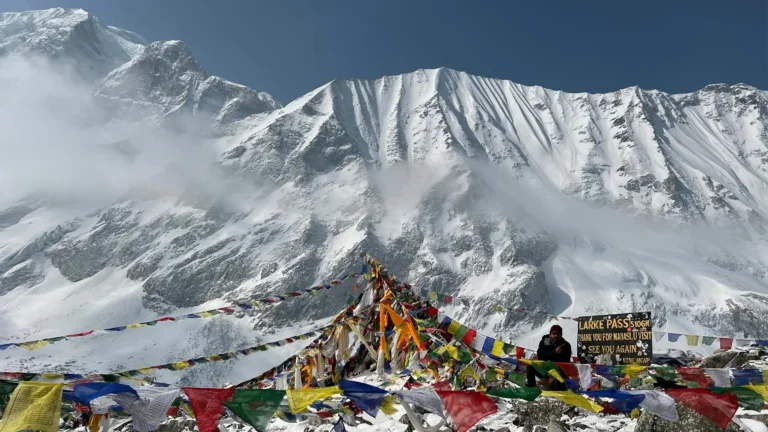
How hard is it? Easier than its reputation suggests. First, there is no pass to cross, and the highest night is 3,700 m at Mu Gompa. Compare that with the Manaslu Circuit, which crosses the Larkya La at 5,106 m. What makes Tsum demanding is not altitude. It is the length, the remoteness, and several long days of climbing on rough trail. So we grade it moderate, and we say so plainly rather than inflating it.
After Kathmandu, the walk follows the Budhi Gandaki north, then turns east at Lokpa into the side valley. Then the landscape opens out and dries. Next you pass Chumling, Chhokangparo and Nile, and finish at Mu Gompa, the highest monastery in the valley. On the way back you visit Rachen Gompa, one of the largest nunneries in Nepal, and Piren Phu, the cave where the poet-saint Milarepa is said to have meditated.
Trips Highlights
- Walk into a valley that stayed closed to foreign trekkers until 2008.
- Mu Gompa (3,700 m), the highest and most remote monastery in Tsum.
- Rachen Gompa, one of the largest Buddhist nunneries in Nepal.
- Piren Phu, the cave where Milarepa is said to have meditated.
- Tsumba culture, Tibetan in language, dress, food and daily life.
- A valley under a shyagya vow of non-violence, where killing animals is prohibited.
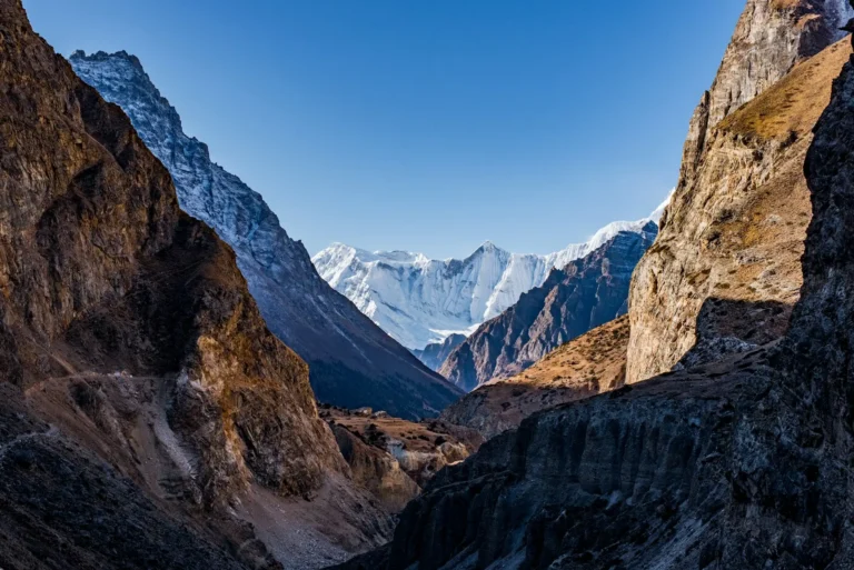
- Views of Ganesh Himal, Sringi Himal and Boudha Himal.
- Far fewer trekkers than the Manaslu Circuit in the next valley.
- A restricted-area trek with no high pass and no night above 3,700 m.
- A cheaper restricted-area permit than the Manaslu Circuit.
Route Details
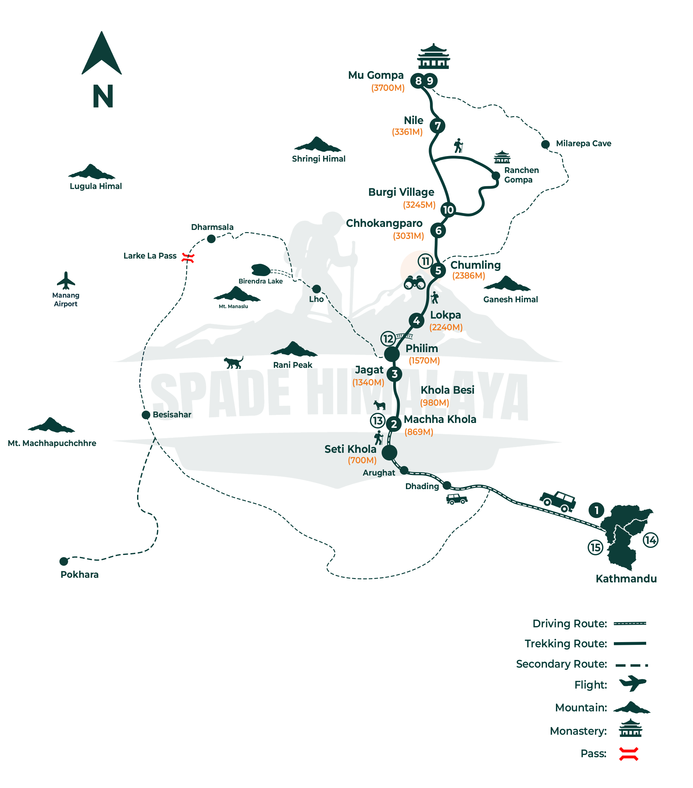
Kathmandu (1,400 m) to Machha Khola (869 m) by road, then Jagat (1,340 m), Lokpa (2,240 m), Chumling (2,386 m), Chhokangparo (3,031 m), Nile (3,361 m) and Mu Gompa (3,700 m). You return by the same valley through Rachen Gompa and Burgi village, then Chumling, Philim (1,570 m) and Machha Khola, and drive back to Kathmandu.
The Spade Himalaya Trek Difficulty Scale
We grade every trek on the same 1 to 5 scale, so you can compare ours against each other honestly.
| Grade | Name | What it means | Example treks |
|---|---|---|---|
| 1 | Easy | Under 3,500 m, short, gentle days | Poon Hill |
| 2 | Moderate | Up to about 4,500 m, no high pass | Tsum Valley (this trek), Annapurna Base Camp, Mardi Himal, Kori |
| 3 | Strenuous | 5,000 to 5,550 m, a base camp or one high pass, good lodges | Everest Base Camp, Annapurna Circuit, Manaslu Circuit, Nar Phu Valley |
| 4 | Challenging | Remote, above 5,000 m, long rough days, simple lodges or some camping | Makalu, Everest Three Passes |
| 5 | Expedition | Very remote, full camping, or several high passes | Upper Dolpo |
Tsum sits at grade 2, moderate. Still, several operators sell it as strenuous. We think that overstates it, because there is no pass and no night above 3,700 m. Overall the honest difficulty is the length and the remoteness.
Trips Itinerary
A Spade Himalaya representative meets you in the arrivals hall and a private car takes you to your hotel in Thamel, about thirty minutes away. The visa on arrival queue can take an hour at busy times.
Your guide runs the briefing later that day, checks your gear item by item and collects the restricted area paperwork. Bring your passport, four photographs and a printed insurance certificate.
Your Tsum permit is issued in Kathmandu before you leave and the office needs a few working days, so arrive at least one full day early rather than cutting it fine.
Friday arrivals are the tightest of all, because the government offices shut for the whole weekend and nothing at all moves again until Sunday morning.
- Duration: Airport transfer, about 30 minutes
- Max Altitude: 1,400 m
- Accommodation: 3 Star Hotel
The longest day in a vehicle on the whole trip. You run west on the Prithvi Highway, then turn north at Arughat and switch to a jeep for the rough road up the Budhi Gandaki gorge.
It is about 140 km and eight to nine hours, finishing at Machha Khola at 869 m. Roughly four of those hours are slow, bumpy dirt track with the river on one side and rock on the other.
Take something for motion sickness before you start rather than halfway, and ask for a front seat. Machha Khola is warm and humid, and charging and mobile signal both still work here.
- Duration: 8 to 9 hours by road, about 140 km
- Max Altitude: 869 m
- Meals: Breakfast, lunch, dinner
- Accommodation: Teahouse
The first walking day, and more up and down than the figures suggest. You follow the river past Khorlabesi and the hot springs at Tatopani, then through the narrowing gorge to Jagat.
That is about 22 km in six or seven hours for roughly 470 m of net ascent, but the trail keeps climbing onto ledges and dropping back to the water, so the real work is greater.
Jagat is the restricted area checkpoint, so keep your passport handy rather than buried in your duffel. The suspension bridges are safe but they bounce, so look at the far end rather than down.
- Duration: 6 to 7 hours, about 22 km, roughly 470 m net ascent
- Max Altitude: 1,340 m
- Meals: Breakfast, lunch, dinner
- Accommodation: Teahouse
Today the Manaslu trek becomes the Tsum trek. You walk through Salleri and Sirdibas to Philim, then turn east into the Shiar Khola while the main trail carries on north.
Lokpa is at 2,240 m, about 15 km and 900 m of net ascent in five or six hours. The last two hours are steep, relentless and mostly in forest, and that is the part people remember.
The crowds disappear the moment you turn off. Lokpa is tiny, a handful of lodges on an exposed shoulder, so expect little choice of food and no hot shower, but a fine view back down the valley.
- Duration: 5 to 6 hours, about 15 km, roughly 900 m net ascent
- Max Altitude: 2,240 m
- Meals: Breakfast, lunch, dinner
- Accommodation: Teahouse
A short day on paper that is harder in practice, dropping several hundred metres to the Shiar Khola through pine and rhododendron forest before climbing back out the far side.
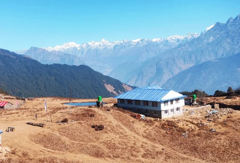
Chumling is at 2,386 m, only 150 m above Lokpa, across about 10 km in four or five hours. It is the first true Tsumba village, with flat roofed stone houses, mani walls and prayer wheels at the entrance, and the short day is deliberate before several nights above 3,000 m.
- Duration: 4 to 5 hours, about 10 km, with a big descent and re-ascent
- Max Altitude: 2,386 m
- Meals: Breakfast, lunch, dinner
- Accommodation: Teahouse
The valley opens out and the walking gets much easier underfoot. You cross to the north bank, pass Rainjam and Serpu, and climb onto the broad upper shelf of the valley.
Chhokangparo is at 3,031 m, about 14 km and 645 m of ascent in five or six hours. Most of the climbing is steady rather than steep, which makes it a pleasant stage.
This is your first night above 3,000 m, so walk at a pace where you could still hold a conversation, drink three to four litres, skip alcohol and report any headache to your guide.
- Duration: 5 to 6 hours, about 14 km, roughly 645 m net ascent
- Max Altitude: 3,031 m
- Meals: Breakfast, lunch, dinner
- Accommodation: Teahouse
A deliberately short day with the best cultural stop of the trek in the middle. You walk to Burgi village, visit the Piren Phu cave above it, then continue through Chhule to Nile.
Nile is at 3,361 m, about 10 km and only 330 m of ascent in four or five hours. The short stage is intentional, because tomorrow you sleep higher again.
Piren Phu is where the poet saint Milarepa is said to have meditated, and it holds old wall paintings and carved tablets. Take your shoes off and do not photograph inside unless you are told it is fine.
- Duration: 4 to 5 hours, about 10 km, roughly 330 m net ascent
- Max Altitude: 3,361 m
- Meals: Breakfast, lunch, dinner
- Accommodation: Teahouse
A short, steady climb up the open valley to the head of Tsum, with old chortens and mani stones along the way and the valley walls closing in around you as you go.
Mu Gompa is at 3,700 m, about 9 km and 340 m of ascent in four or five hours. There are no villages or lodges on this stretch, so carry water and snacks from Nile before you set off.
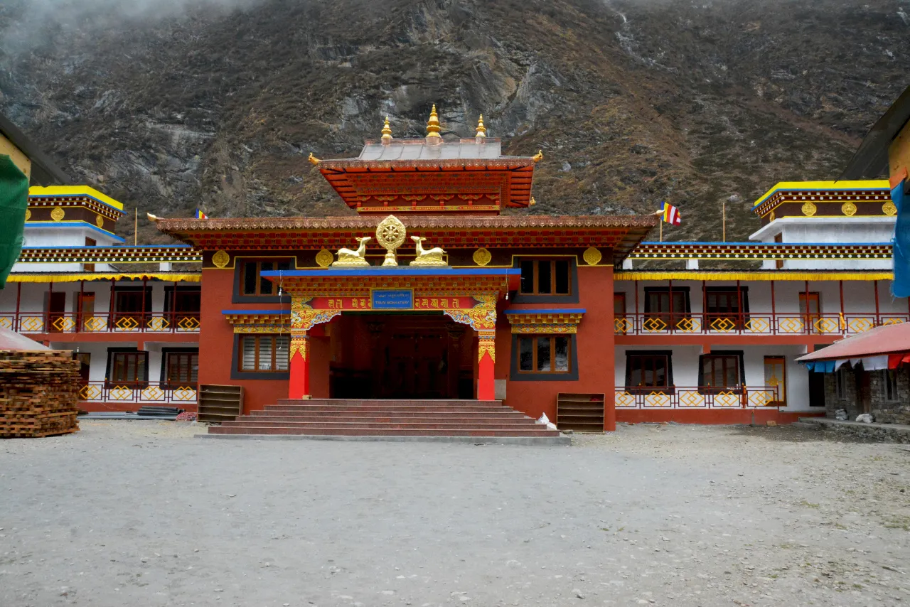
The monastery is the largest and the highest one in Tsum, and it stands on its own on a shelf below the Tibetan border with nothing else around it at all.
Conditions up here are unheated rooms, an outside toilet, no hot shower and no mobile signal, and the nights are cold even in October, so use your down jacket.
- Duration: 4 to 5 hours, about 9 km, roughly 340 m net ascent
- Max Altitude: 3,700 m
- Meals: Breakfast, lunch, dinner
- Accommodation: Teahouse or monastery guesthouse
A day without a full pack, and it is here for a reason rather than as filler. Most groups walk up towards Dhephyudonma Gompa, an older and even more isolated monastery above the valley.
That side walk reaches roughly 4,000 m and takes three to four hours up and back, then returns you to sleep at 3,700 m. Climbing high and sleeping low is exactly what helps here.
The flatter alternative heads north along the old trading route toward the border, and resting at the monastery is a perfectly good third option. This is also the buffer day if anyone is struggling.
- Duration: 3 to 4 hours on the side walk, or a full rest
- Max Altitude: About 4,000 m on the side walk
- Meals: Breakfast, lunch, dinner
- Accommodation: Teahouse or monastery guesthouse
You turn back down the valley today but take the opposite bank, so almost none of the ground is a repeat of the way up, and the main stop is Rachen Gompa.
Burgi village is at 3,245 m, about 16 km and 455 m of net descent in six or seven hours. Rachen Gompa is a large nunnery on the valley floor with a richly painted prayer hall, and several of the nuns speak some English, so it is worth more than a quick look.
- Duration: 6 to 7 hours, about 16 km, roughly 455 m net descent
- Max Altitude: 3,700 m at the start
- Meals: Breakfast, lunch, dinner
- Accommodation: Teahouse
A long descent back down the valley you spent three days climbing, retracing the route through Chhokangparo and dropping steadily into the forest again.
Chumling is at 2,386 m, about 16 km and 860 m of net descent in six or seven hours. Nothing is technical, but six hours of downhill is hard on the knees, so use poles. The views are better this way round, because Ganesh Himal is in front of you all morning rather than behind.
- Duration: 6 to 7 hours, about 16 km, roughly 860 m net descent
- Max Altitude: 3,245 m at the start
- Meals: Breakfast, lunch, dinner
- Accommodation: Teahouse
Down through the forest to the Shiar Khola and then the steep drop that returns you to the main Budhi Gandaki valley and the Manaslu trail near Philim.
Philim is at 1,570 m, about 17 km and 815 m of net descent in six or seven hours, and the first two hours are the steepest walking of the whole return leg. The contrast when you rejoin the main trail is striking, with other trekkers, bigger lodges and traffic on the path.
- Duration: 6 to 7 hours, about 17 km, roughly 815 m net descent
- Max Altitude: 2,386 m at the start
- Meals: Breakfast, lunch, dinner
- Accommodation: Teahouse
A long day on the map but an easy one in practice, following the Budhi Gandaki south through Jagat, Yaruphant and Tatopani, downhill almost the whole way.
Machha Khola is at 869 m, about 22 km and 700 m of net descent in six or seven hours. Your permit is checked again at Jagat as you leave the restricted area, so keep your passport to hand.
The air gets thicker, warmer and more humid every hour, and most people walk faster than they have all trip. This is the night to settle tips with your porters, who usually leave the group here.
- Duration: 6 to 7 hours, about 22 km, roughly 700 m net descent
- Max Altitude: 1,570 m at the start
- Meals: Breakfast, lunch, dinner
- Accommodation: Teahouse
The same long road out in reverse, rough for the first four hours and then straightforward once the sealed highway returns near Arughat or Dhading Besi.
It is 140 km and eight to nine hours back to Kathmandu at 1,400 m, and city traffic can add an hour at the end, so this is not a day on which to book an evening flight. There is a farewell dinner with your guide in the evening, usually in Thamel with some music.
- Duration: 8 to 9 hours by road, about 140 km
- Max Altitude: 1,400 m
- Meals: Breakfast, lunch, dinner
- Accommodation: 3 Star Hotel
A Spade Himalaya vehicle collects you from your hotel and takes you to Tribhuvan International Airport about three hours before your flight, as the airlines ask on international departures.
If your flight is late, most hotels hold bags after checkout, so you can spend the morning in Patan or Boudha. Tell us if you are staying on and we can arrange onward trips or transport to Pokhara.
- Duration: Airport transfer, about 30 minutes
- Max Altitude: 1,400 m
- Meals: Breakfast
Trips Include
- Airport transfers in a private vehicle.
- 2 nights in a 3 star hotel in Kathmandu with breakfast, on a twin-sharing basis.
- All teahouse and lodge accommodation during the trek.
- All meals (breakfast, lunch, dinner) during the trek.
- Tsum Valley Restricted Area Permit and Manaslu Conservation Area Permit (MCAP), plus the Chumnubri Rural Municipality entry fee.
- A licensed, experienced, English-speaking guide.
- A porter for every two trekkers, with a load limit we actually enforce.
- Guide and porter wages, food, accommodation, insurance and equipment.
- Private ground transport, Kathmandu to Machha Khola and back.
- A sleeping bag and down jacket for use on the trek, returned afterwards.
- A duffel bag, a trekking map and a first aid kit with a pulse oximeter.
- All government and local taxes.
- A farewell dinner in Kathmandu.
Trips Exclude
- International airfare to and from Nepal.
- Nepal entry visa (USD 30 for 15 days, USD 50 for 30 days, USD 125 for 90 days, paid on arrival).
- Travel insurance. This is mandatory and it must cover helicopter evacuation to at least 4,000 m.
- Lunch and dinner in Kathmandu.
- Personal trekking gear and clothing.
- Hot showers, device charging, Wi-Fi and hot drinks on the trail.
- Bottled or boiled drinking water.
- Tips for the guide and porters.
- Extra nights in Kathmandu if you arrive early or the trek finishes late.
- Anything caused by delays outside our control, such as weather or road closures.
- Anything not listed under Cost Includes.
Trips Map
Packing List
General
- Four-season (zero degree) sleeping bag.
- Sleeping bag liner, worth bringing because lodges here are basic
- Puffy down jacket.
- Duffel bag (provided by Spade Himalaya, carried by the porter, returned after the trek)
- Daypack, 30 to 45 litres, with a rain cover
- Trekking poles, genuinely useful on the two steep climbs and on the long descents
- Headlamp with spare batteries
- Power bank, because charging is limited and stops entirely above Nile
- Reusable water bottle of at least one litre
Upper Body
- Sun hat and a warm beanie
- Sunglasses with good UV protection
- Two or three technical base layers
- Two long-sleeve trekking shirts
- Fleece or light insulated midlayer
- Waterproof and windproof shell jacket
Hands
- Liner gloves for walking
- Warmer insulated outer gloves for Mu Gompa and the early mornings
Lower Body
- Two pairs of trekking trousers
- Thermal base layer bottoms for the nights at Mu Gompa
- Waterproof overtrousers
- Comfortable clothes for the lodges in the evening
Undergarments
- Quick-drying technical underwear
- Sports bras if you wear them
- Something separate to sleep in, since lodge rooms are unheated
Feet
- Broken-in waterproof trekking boots, not new ones
- Four or five pairs of trekking socks
- Sandals or light shoes for the evenings
- Microspikes if you are trekking between December and March
- Gaiters for the monsoon or for snow
First Aid Kits
- Personal medication in its original packaging
- Blister plasters and tape, because day 3 and day 4 are where blisters start
- Rehydration salts
- High-factor sunscreen and lip balm with UV protection
- Paracetamol or ibuprofen for headaches
- Any altitude medication your doctor has prescribed
Others
- Passport, plus two photocopies kept separately
- Four passport-sized photographs for the permits
- Travel insurance certificate covering helicopter evacuation to at least 4,000 m
- Nepali rupees in cash, since there are no ATMs anywhere on this route
- Water purification tablets or a filter as a backup
- Toilet paper and hand sanitiser
- Quick-drying towel
- Earplugs, because lodge walls are thin
Good to Know
Before you go
You need your passport, four passport photos and a copy of your insurance certificate. Your insurance must cover helicopter evacuation to at least 4,000 m, and we do check. Because Tsum is a restricted area, your permit is issued in Kathmandu before you leave, so we need those documents at least three days ahead. So send us scans as soon as you book.
This is the part of a Tsum quote most worth reading carefully.
A Tsum Valley trek needs the Tsum Valley Restricted Area Permit, which is USD 40 per person for the first seven days in the September to November season, and USD 30 from December to August, then about USD 7 per day after that. It also needs the Manaslu Conservation Area Permit at NPR 3,000, and a small Chumnubri Rural Municipality fee collected locally.
What it does not need is the Manaslu restricted permit at USD 100 per week, unless you carry on around the Circuit. It also does not need a TIMS card, because a restricted-area permit replaces it. Still, several well-known operators list one or both. Read your quote.
One honest caveat. When we checked on 20 August 2026, the Department of Immigration website was not reachable, so these figures come from our own permit filings and from our Manaslu permit guide rather than from a live government page that day. Nepal changes permit fees without much notice. So we re-confirm every figure at the moment you book, and we would rather tell you that than pretend a number is fixed.
Tsum Valley has required a licensed guide for far longer than Nepal’s general trekking regions, because it is a restricted border area.
On 22 March 2026 the Department of Immigration removed the old requirement for a minimum of two trekkers in restricted areas (Kathmandu Post, 2026). So a solo traveller can now hold a Tsum Valley permit in their own name, which was not possible before.
However, two rules did not change. You still need a licensed guide with you, and the permit must still be issued through a registered agency. So this is not a route you can walk independently, whatever you may read on a forum. Spade Himalaya is a registered agency and our guides hold current Nepal licences.
Tsum lives under a shyagya vow, a binding community pledge of non-violence. Killing animals is prohibited in the valley, and so is hunting. Also the vow has been renewed by the community over many years and it is taken seriously.
In practice this means no meat is slaughtered or served in the valley. You will eat vegetarian food for about a week, and it is good food. Expect dal bhat, potatoes, Tibetan bread, noodles and eggs lower down.
Please do not bring meat in with you, and do not ask a lodge to make an exception. This is one of the reasons the valley feels the way it does, and it belongs to the people who live there rather than to visitors.
They start on the same trail and split at Philim, so people often ask which to choose.
Take the Manaslu Circuit if you want big mountain scenery and a serious high pass. It crosses the Larkya La at 5,106 m, it circles an 8,000 m peak, and it is a harder trek in every sense. Read our Manaslu Circuit page for that one.
Take Tsum Valley if the culture is the point, if you would rather not cross a 5,000 m pass, and if you want to see far fewer people. The permit is cheaper too.
You can also combine the two into a single longer trek of around 21 to 24 days. If that interests you, ask us and we will build it. If you like the idea of a quiet restricted valley, our Nar Phu Valley Trek has a similar feel, and the Tamang Heritage Trek is an easier way into Tibetan-influenced culture.
Trips Reviews
No reviews found.
Trips FAQs
Permits and Rules
You need three things. First, the Tsum Valley Restricted Area Permit, which costs USD 40 per person for the first seven days from September to November, and USD 30 per person for the first seven days from December to August. After that it is about USD 7 per person per day. Second, the Manaslu Conservation Area Permit (MCAP), which is NPR 3,000 for non-SAARC visitors. Third, a small Chumnubri Rural Municipality entry fee collected locally. So Spade Himalaya arranges all of them, and they are in your trip price. Permit rules in Nepal do change, so we confirm the current figures when you book rather than quoting an old number.
Not for a Tsum Valley trek on its own. This is the single most common error in Tsum quotes. The Manaslu restricted permit costs USD 100 per week in high season, while the Tsum Valley one costs USD 40. They are separate permits for separate areas. You only need both if you combine Tsum with the Manaslu Circuit and carry on over the Larkya La. If someone quotes you the Manaslu rate for a Tsum-only trek, ask them to explain it.
No. The TIMS card applies to general trekking areas. In a restricted area the restricted-area permit replaces it, so you do not carry a TIMS card for Tsum. Still, several operator websites list TIMS in their Tsum inclusions. That is out of date, and if you are paying for it separately you are paying for nothing.
You can now apply as a single trekker, but you still cannot walk it unguided. In March 2026 the Department of Immigration removed the old two-person minimum for restricted areas (Kathmandu Post, 2026). However, it kept the two rules that matter: you must have a licensed guide, and the permit must be issued through a registered agency. So solo travellers are welcome on this trek. Trekking it alone and unguided is still not permitted.
Difficulty and Altitude
It is a moderate trek, grade 3 on our scale. You walk five to seven hours a day for about ten days. There is no pass to cross and no technical ground at all. The hard parts are the two steep climbs, at Lokpa and out of the Shiar Khola, and the sheer remoteness. So anyone reasonably fit who trains beforehand can finish it. Still, some operators grade Tsum as strenuous, and we think that oversells it.
The highest point you sleep at is Mu Gompa, 3,700 m (12,139 ft). On the acclimatization day you walk a few hundred metres higher towards Dhephyudonma Gompa and come back down to sleep. So this trek stays well below the altitudes of the Everest and Annapurna circuits. That makes it a good choice if high passes worry you.
The risk is real but it is lower here than on most Nepal treks, because you gain height gradually and never sleep above 3,700 m. The Wilderness Medical Society treats 2,500 m as the level above which altitude illness becomes a genuine concern, and you cross that on day six. So the itinerary builds in a full rest day at Mu Gompa. Also your guide carries a pulse oximeter and checks the group daily. So if anyone shows symptoms, the answer is always to descend.
No, but you do need to be fit. If you can walk six hours on hilly ground on consecutive days, you will manage. We suggest two months of preparation, ideally hill walking with a loaded pack. Because the valley is remote, the nearest road is several days away, so arriving fit matters more here than on a trek with easy exits.
Culture, Food and the Shyagya Vow
The valley lives under a shyagya vow, a community pledge of non-violence that prohibits the killing of animals. Hunting is prohibited with it. So no meat is slaughtered or sold in the valley, and you will eat vegetarian for roughly a week. Still, the food is good, mostly dal bhat, potatoes, noodles and Tibetan bread. This is not a restriction invented for visitors, and we ask guests to respect it fully.
First, the Tsumba are the people of the valley. Today they speak a Tibetan dialect, follow Tibetan Buddhism, and are far closer in culture to Tibet than to Kathmandu. Tsum was historically a small independent kingdom, and it kept strong trading and religious ties across the border. Because the valley only opened to foreign trekkers in 2008, daily life here has changed much less than in the big trekking regions.
Mu Gompa (3,700 m) is the highest and most remote monastery in Tsum, sitting near the head of the valley below the Tibetan border. It is the furthest point of this trek. Rachen Gompa is a large nunnery lower down the valley, and it houses one of the bigger communities of Buddhist nuns in Nepal. You visit it on the way back down.
Piren Phu is a cave shrine near Burgi village, and it is one of the most sacred places in the valley. Local tradition holds that the Tibetan poet-saint Milarepa meditated here. Also there are wall paintings, carved stone tablets and old scriptures inside. You visit it on day seven, on the walk to Nile.
When to Go
October and November are the best months, with clear air and stable weather. March to May is the second window, warmer and with rhododendron in flower lower down. Search interest for this trek peaks in October, and so does the trail traffic, though Tsum is quiet even at its busiest.
Winter is possible but cold, and some lodges high in the valley close. If you go in December or January, expect hard frost and the chance of snow above Chhokangparo, and carry microspikes. The monsoon, roughly June to mid-September, is the harder call. First, the rain brings leeches and landslides on the approach, and the long drive becomes unreliable. However, the upper valley sits partly in a rain shadow, so it is drier up there than the approach suggests. We would rather be honest: it is doable, but it is not the trek at its best.
On the Trail
Simple teahouses and family lodges the whole way, and they are more basic than on the Everest or Annapurna routes. So expect a twin room with a plywood partition and a shared toilet. At Mu Gompa the accommodation is very simple and may be in the monastery guesthouse. So bring a sleeping bag liner. We provide the sleeping bag.
Patchy, and then none. There is usually some signal as far as Chumling and Chhokangparo, though it comes and goes. Above Nile you should assume you have no coverage at all. Still, a few lodges sell Wi-Fi lower down. So tell people at home that you will be out of contact for several days, because it saves a lot of worry.
There are no ATMs anywhere on this trek. The last reliable machines are in Kathmandu, so draw your cash there and carry Nepali rupees. So budget roughly USD 15 to 20 a day for drinks, charging, hot showers and snacks, plus your tips. Bring more than you think, because there is no way to top up once you start.
There is spring and tap water all along the trail, but you must treat it. We give you filtered or treated water rather than selling you bottles, because plastic bottles are a genuine problem in a valley with no waste collection. So bring a reusable bottle of at least one litre.