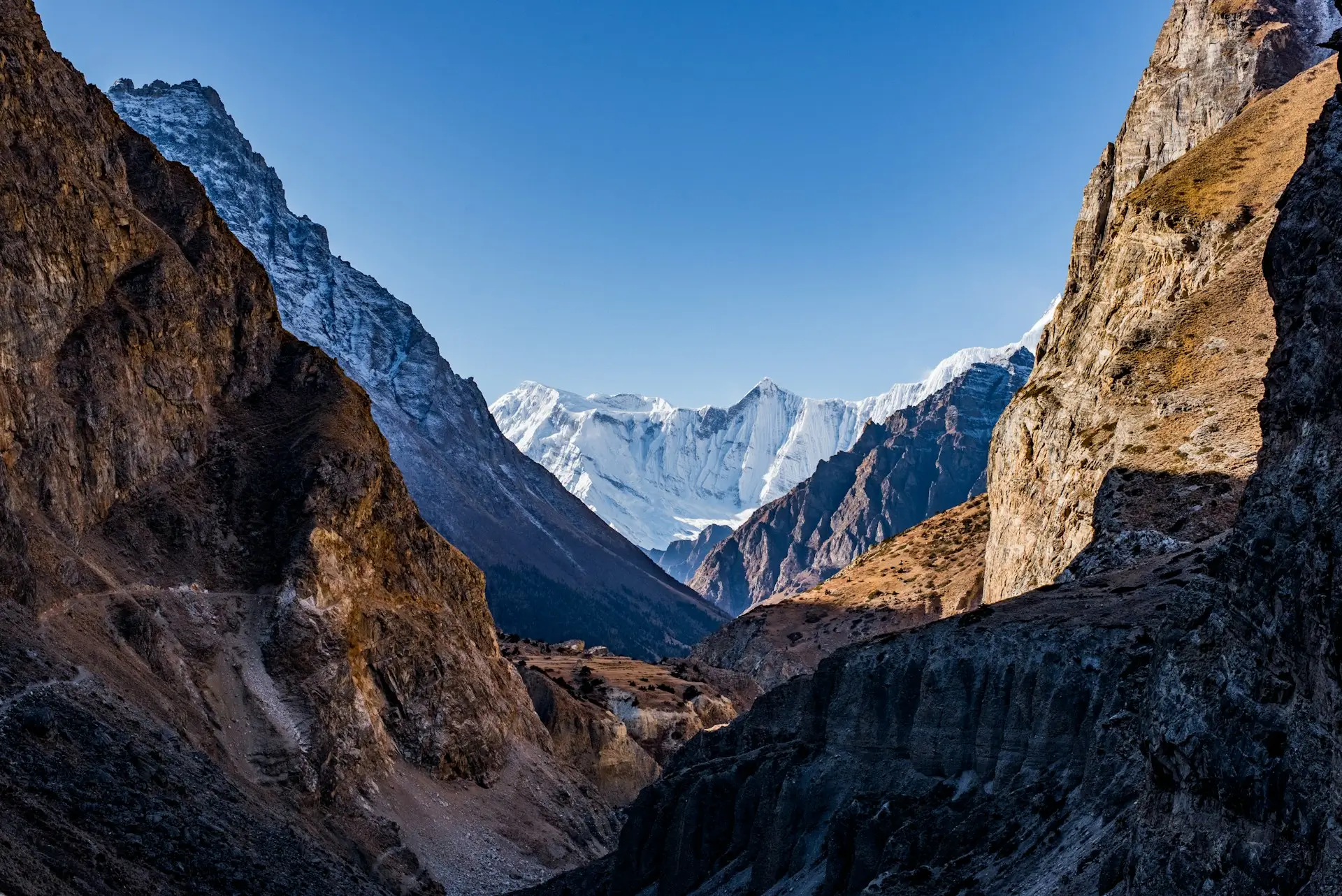
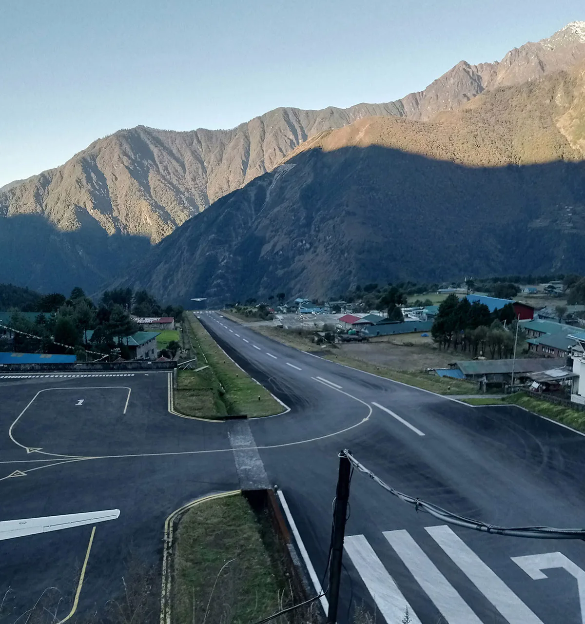
Quick answer: Lukla’s Tenzing-Hillary Airport is the gateway to Everest Base Camp, famous for a 527 m runway that slopes at 11.7% and ends against a mountain wall. A television program crowned it the world’s most dangerous airport. In practice, strict morning-only flight rules manage that risk, and for trekkers the real problem is not the landing. It is the weather delay. The same skies rule conditions up high, so it helps to know Everest Base Camp weather by month.
Every Everest story begins with twenty of the strangest minutes in commercial aviation. Your small plane leaves the haze of the lowlands, threads between ridges, and aims at a short strip of tarmac tilted up the side of a hill at 2,846 m. Then it stops in less distance than some airports use for taxiing. Welcome to Lukla.
Key Takeaways
- The runway is 527 m long with an 11.7% slope, at 2,846 m (9,337 ft).
- The “world’s most dangerous airport” label came from a History Channel program in 2010.
- Flights run under visual flight rules only, almost always in the early morning.
- In peak trekking months, flights leave from Manthali (Ramechhap), a 4 to 6 hour drive from Kathmandu, then 20 minutes in the air.
- Budget about US$400 round trip; a helicopter seat runs about US$550.
- Our guides’ rule: build one buffer day into every Everest itinerary for the flight.
This guide explains the famous runway, the honest safety picture, and the practical playbook our team uses for delays. For the treks on the other side of the flight, start with our Everest region trekking guide.
What is Lukla Airport?
Lukla Airport is the small mountain airstrip that serves the entire Everest region. Nearly every trekker bound for Everest Base Camp lands here, at the edge of a Sherpa town perched above the Dudh Koshi valley.

The airstrip has history in its bones. Edmund Hillary himself supervised its construction in 1964, buying the land from local Sherpa farmers for US$2,650 and hiring them to build it. The runway stayed dirt until 2001, when it was finally paved. And in February 2008, Nepal officially renamed it Tenzing-Hillary Airport, honoring the two men who first stood on top of Everest. Locals and trekkers still call it Lukla.
The airport sits in the Solukhumbu district of eastern Nepal, and only small short-takeoff aircraft can use it, mainly the Twin Otter, the Dornier 228, and the Let L-410, plus helicopters.
There is no road to Lukla. So this strip of tarmac is, in a very real sense, the front door of the Khumbu.
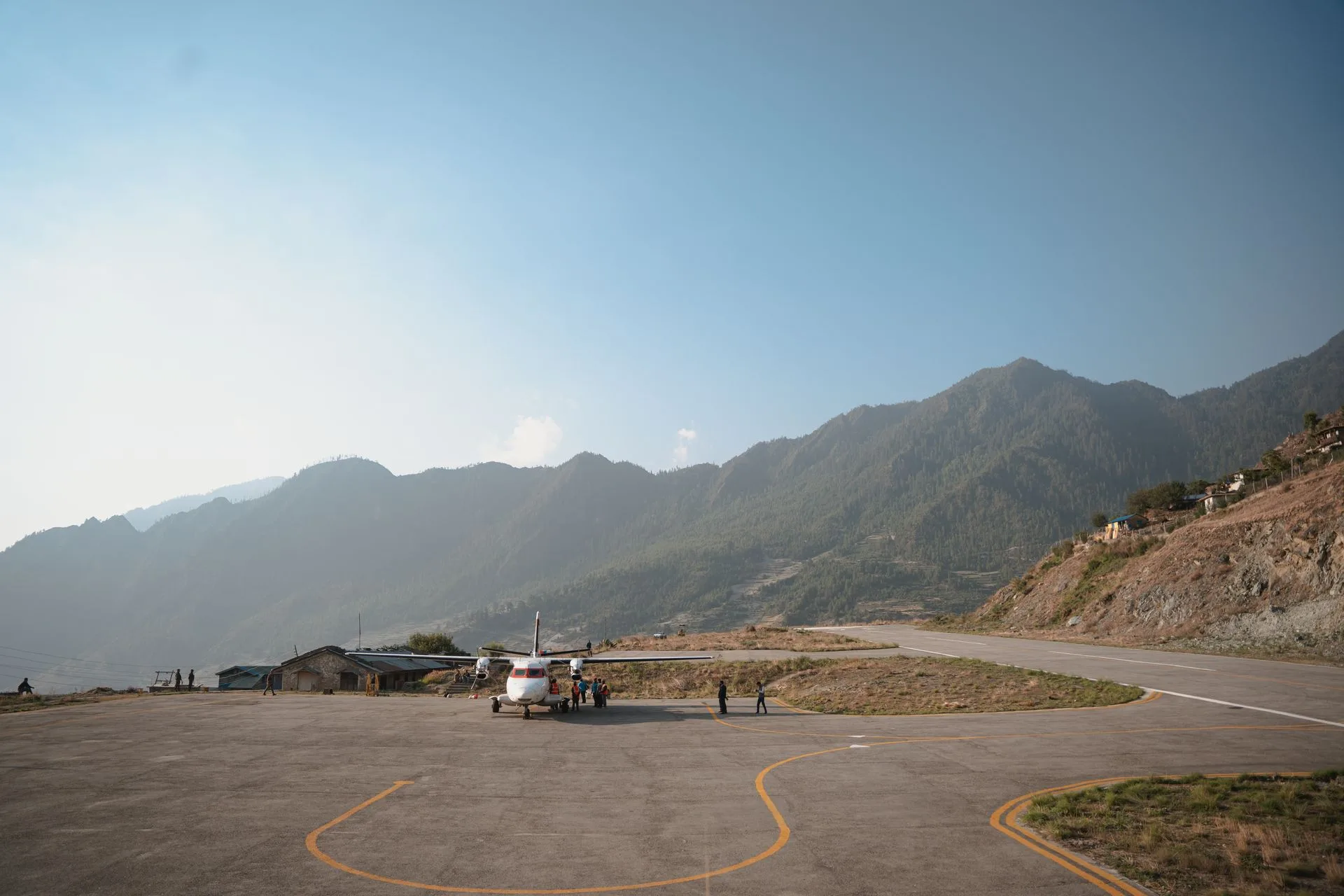
A twin-engine plane sits on the tarmac at Tenzing-Hillary Airport in Lukla, Nepal, surrounded by massive Himalayan peaks.
Why is it called the world’s most dangerous airport?
The label came from television. In 2010, a History Channel program named Most Extreme Airports rated Lukla the most dangerous airport in the world, and the name stuck. The reasons are easy to see from the window seat.
| The runway, by the numbers | |
|---|---|
| Length | 527 m (1,729 ft) |
| Width | 20 m |
| Slope | 11.7% uphill gradient |
| Elevation | 2,846 m (9,337 ft) |
| Go-around option | None |
Here is what those numbers mean. The strip is about a tenth the length of a major international runway. It tilts uphill so hard that the slope itself helps planes brake on landing and accelerate on takeoff. At the top end stands a mountain wall. At the bottom end, the ground drops away into the valley. So once a pilot commits to landing, there is no circling back for a second try.
How dangerous is the flight, really?
Honestly: the label describes the runway’s thin margins, not your odds on a given morning. Because the margins are thin, the rules around them are strict, and those rules are the real safety system.
Flights operate under visual flight rules only. If pilots cannot see the strip, nobody flies, full stop. Almost all departures are scheduled for early morning, before the strong southwest winds that close the airport from mid to late morning. In the monsoon, visibility problems close it about half the time. Each of those cancellations frustrates trekkers, and each one is the system doing its job.
Our guides have flown this route for years, and their view is consistent. The flight is short, loud, spectacular, and handled by crews who land here every day. What deserves your planning energy is not fear of the landing. It is the schedule.
How do you fly to Lukla?
The departure point depends on the season, and the peak-season answer surprises people.
| Season | Departure | What it looks like |
|---|---|---|
| Peak months (Mar to May, Oct, Nov) | Manthali, Ramechhap | 4 to 6 hour drive from Kathmandu, then a 20 minute flight |
| Quieter months | Kathmandu direct | A short mountain flight from the capital |
| Any season, bigger budget | Helicopter | About US$550 per person to Lukla |
The rerouting to Manthali exists because Kathmandu’s airport is congested in peak season. It adds a pre-dawn drive to the trip, and yes, it is nobody’s favorite part. On our treks, the transfers are arranged and the timings handled for you.
For money planning, the round-trip flight costs about US$360 to US$480, which makes it the single biggest line in most Everest budgets. Our Everest Base Camp cost guide breaks down the rest.
What happens when flights are delayed or cancelled?
Sooner or later, Lukla weather humbles every schedule. The difference between a ruined trip and a shrug is planning for it. Here is the playbook we run for our own groups:
- Fly the first slots. Morning weather is the most reliable, so early departures have the best completion rate. We book accordingly.
- Build a buffer day. One spare day in Kathmandu at the end of the itinerary absorbs most delays. Because of this, our 14-day itinerary is really a 12-day trek wearing sensible insurance.
- Know the helicopter fallback. When fixed-wing flights back up for days, helicopters often still fly. A seat costs more, and in a pinch it saves an international connection.
- Insure the gap. Pick travel insurance that covers weather delays and helicopter evacuation. Our packing and prep guide covers the boring paperwork that matters.
In short, treat the flight like the first pass of the trek: respect it, plan margin around it, and it rewards you.
When is the best time to fly to Lukla?
October gives the most reliable flying weather of the year, with the post-monsoon air at its clearest. Spring mornings run a close second. The monsoon months are the gamble, with the airport closed about half the time, and winter is cold but often clear.
The pattern matches trekking conditions generally, and that is no accident. Both depend on the same skies. For the month by month picture, see our guide to the best time to trek to Everest Base Camp. And once you land, the trail rises toward Namche, the passes, and the climb our guides call the best fifteen minutes in the Khumbu: Kala Patthar.
FAQs
How long is the runway at Lukla Airport?
527 m, about a tenth of a major international runway, with an 11.7% uphill slope that helps aircraft stop on landing and accelerate on takeoff.
How long is the flight to Lukla?
About 20 minutes from Manthali in peak season. From Kathmandu in quieter months, it is a short mountain flight of roughly half an hour.
Why is it named Tenzing-Hillary Airport?
Nepal renamed the airport in February 2008 to honor Tenzing Norgay and Edmund Hillary, the first climbers to summit Everest. Most people still say Lukla.
How much does the Lukla flight cost?
About US$360 to US$480 round trip, moving with season and fuel prices. A helicopter seat to Lukla runs about US$550 per person.
Do flights to Lukla run during the monsoon?
They try. But visibility closes the airport about half the time in monsoon season, so delays and cancellations are the norm. Most trekkers simply avoid those months.
What planes fly to Lukla?
Small short-takeoff aircraft built for strips like this one: the Twin Otter, the Dornier 228, and the Let L-410, alongside helicopters.
What are the airport codes for Lukla?
IATA code LUA, ICAO code VNLK. When booking, search for Lukla or Tenzing-Hillary Airport, Nepal.
Has Lukla Airport had accidents?
Yes. The airport’s history includes serious accidents, and that record is exactly why today’s rules are so strict. So flights only operate in clear morning conditions, under visual flight rules, with crews who fly this route daily. When conditions fall short, flights simply do not go.
How far is Everest Base Camp from Lukla?
About 130 km round trip on foot, or roughly 65 km each way, walked over 12 to 14 days. For the daily stages, our Everest Base Camp distance guide breaks down the full route.
Do trekkers sleep in Lukla?
Usually only on the way out. When you land, most groups start walking toward Phakding the same morning. Then, before the return flight, many spend a night in Lukla to catch the reliable early slots.
Accuracy note: runway, elevation, and operations figures from the public aviation record for Tenzing-Hillary Airport (reference, retrieved 2026-07-04); flight costs and seasonal routing match our published trip pages; delay playbook reviewed by Yubaraj Katel, government-licensed trekking guide (Licence No. 19827) with 10 years of experience leading treks in the Everest region.

Keep Planning Your Trek
Updated: 6 Jul, 2026
9 min
Everest Base Camp Trek Cost in 2026: Full Breakdown
Quick answer: A guided Everest Base Camp Trek’s biggest single cost is the round-trip Lukla flight,...
Updated: 8 Oct, 2026
10 min
Everest Helicopter Tour: Is It Worth It? Cost, Safety and the Reality
Is the Everest helicopter tour worth it? An honest look at the cost, the safety, why...
Updated: 20 Jul, 2026
15 min
Everest Region Treks: Routes, Cost & Best Time (2026 Guide)
Quick answer: The Everest region, or Khumbu, is home to Everest Base Camp, the Gokyo Lakes,...