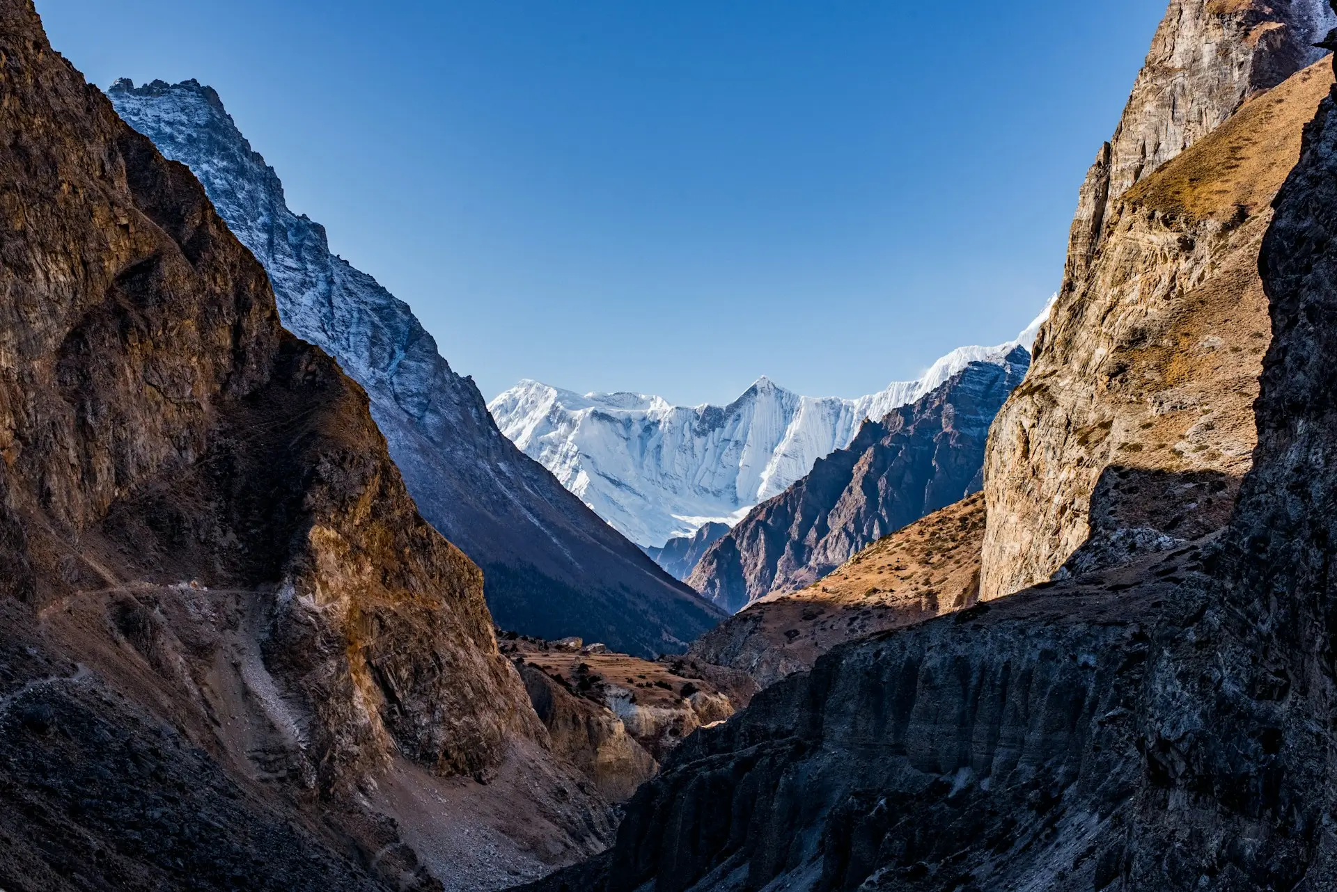
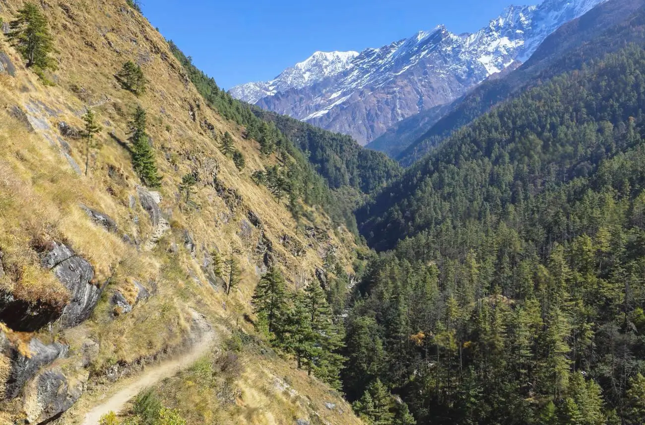
Quick answer: The standard Tsum Valley Trek runs 15 days from Kathmandu, with about ten walking days and roughly 120 km on foot. It climbs from Machha Khola at 869 m to Mu Gompa at 3,700 m, with the biggest single day being the 900 m climb from Jagat to Lokpa. There is no pass on the route.
Most Tsum Valley itineraries you find online list village names and nothing else. That is not much help when you are trying to work out whether you can walk it, or how hard any given day will be.
So this guide gives the numbers: hours, approximate distance, and net height gained or lost for every stage. Where a figure is derived rather than measured, we say so.
Key Takeaways
- 15 days from Kathmandu, about ten walking days.
- Roughly 120 km on foot, plus two long road days of about 140 km each.
- Highest sleeping point is Mu Gompa, 3,700 m. No pass to cross.
- The hardest day is Jagat to Lokpa, roughly 900 m of net ascent.
- You cross 2,500 m on day four and only reach 3,700 m on day eight.
- The return uses the opposite bank, so most of it is new ground.
How do you get to the trailhead?
By road from Kathmandu to Machha Khola, and it takes 8 to 9 hours.
First the road runs west on the Prithvi Highway towards Dhading, and that section is sealed and straightforward. After Arughat the road turns north up the Budhi Gandaki gorge and becomes rough dirt track.
So you switch to a jeep for the second half. Expect about four hours of slow, bumpy driving with the river on one side and rock on the other. If you are prone to motion sickness, take something before you set off rather than halfway, and ask for a front seat.
Also there is no airstrip and no shortcut. That drive is the only way in, and it is the same drive out at the end.
The full 15-day itinerary with distances
First, a note on the figures. Distances below are approximate. Net ascent and descent are calculated from the village altitudes in the same table, so they show the overall change rather than every rise and fall along the way. In practice the real climbing is greater, because the trail undulates.
| Day | Stage | Altitude | Distance | Hours | Net change |
|---|---|---|---|---|---|
| 1 | Arrive Kathmandu | 1,400 m | |||
| 2 | Drive to Machha Khola | 869 m | 140 km | 8 to 9 | By road |
| 3 | Machha Khola to Jagat | 1,340 m | 22 km | 6 to 7 | Up 471 m |
| 4 | Jagat to Lokpa | 2,240 m | 15 km | 5 to 6 | Up 900 m |
| 5 | Lokpa to Chumling | 2,386 m | 10 km | 4 to 5 | Up 146 m net |
| 6 | Chumling to Chhokangparo | 3,031 m | 14 km | 5 to 6 | Up 645 m |
| 7 | Chhokangparo to Nile | 3,361 m | 10 km | 4 to 5 | Up 330 m |
| 8 | Nile to Mu Gompa | 3,700 m | 9 km | 4 to 5 | Up 339 m |
| 9 | Acclimatization at Mu Gompa | 3,700 m | 8 km | 3 to 4 | Up and back to about 4,000 m |
| 10 | Mu Gompa to Burgi via Rachen Gompa | 3,245 m | 16 km | 6 to 7 | Down 455 m |
| 11 | Burgi to Chumling | 2,386 m | 16 km | 6 to 7 | Down 859 m |
| 12 | Chumling to Philim | 1,570 m | 17 km | 6 to 7 | Down 816 m |
| 13 | Philim to Machha Khola | 869 m | 22 km | 6 to 7 | Down 701 m |
| 14 | Drive to Kathmandu | 1,400 m | 140 km | 8 to 9 | By road |
| 15 | Departure |
So that comes to roughly 120 km of walking. So the daily average is about 14 km, which is modest. However, the terrain is steep in places and the trail surface is rough, so the hours are longer than the distance suggests.
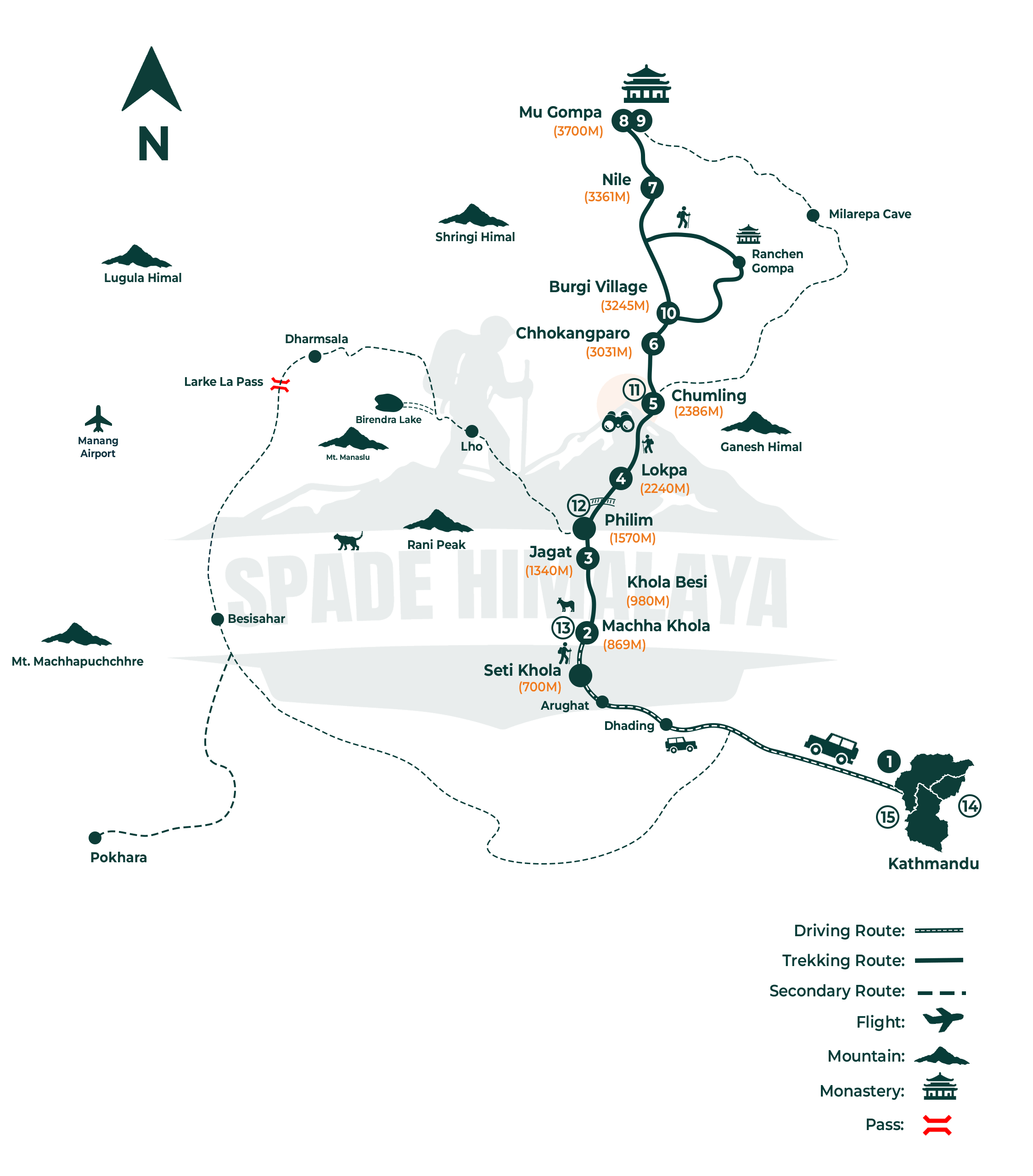
Our own Tsum Valley trek map. The route runs Machha Khola (869 m), Jagat (1,340 m), Lokpa (2,240 m), Chumling (2,386 m), Chhokangparo (3,031 m) and Nile (3,361 m) to Mu Gompa (3,700 m), returning down the far bank past Rachen Gompa and Burgi village.
Which day is the hardest?
Day four, Jagat to Lokpa, with about 900 m of net ascent.
Also this is the day the two routes separate. First you walk gently through Salleri and Sirdibas, cross the river, and climb to Philim, which is where most groups stop for lunch.
After Philim the Manaslu Circuit continues north. Instead you turn east into the Shiar Khola, and the climbing begins in earnest. The last two hours to Lokpa are steep, sustained and mostly in forest. So this is the section people remember.
Still, day five looks easy on paper at only 146 m of net gain. In practice it is harder than that, because the trail drops several hundred metres to the Shiar Khola before climbing back out the other side. Net figures hide that kind of day, which is why we list the hours as well.
What does the altitude profile look like?
Gradual, which is the best thing about this trek.
First you leave Machha Khola at 869 m, taking six days to reach 3,031 m at Chhokangparo. Then you gain only another 670 m over the following two days before arriving at Mu Gompa.
So that spacing matters. The Wilderness Medical Society treats 2,500 m as the level above which altitude illness becomes a genuine concern, and you cross it on day four. From there you gain height slowly, and the itinerary includes a full rest day at the top.
So altitude problems are less common here than on the bigger Nepali routes. They are not impossible, though, and our guide to altitude sickness on Nepal treks covers what to watch for.
What happens on the acclimatization day?
You walk higher without a full pack, then come back down to sleep.
Here the usual option is a side walk towards Dhephyudonma Gompa, an older and more isolated monastery set high above the valley at roughly 4,000 m. It takes three to four hours there and back, carrying only a daypack.
That gains a few hundred metres and returns you to sleep lower, which is exactly the pattern that helps you acclimatize. Alternatively you can walk north towards the old trading route to the Tibetan border, which is flatter and easier on tired legs.
Because this is the only buffer day in the itinerary, it doubles as your safety margin. So if anyone in the group is struggling, this is the day that absorbs it.
Is the return the same trail?
Mostly not, and that is a nice surprise.
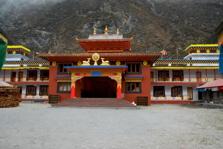
Instead, from Mu Gompa you come back down the opposite bank of the valley, so days ten and eleven cover largely new ground. That leg takes in Rachen Gompa, a large nunnery on the valley floor, and Burgi village.
Then from Chumling downwards you retrace the route you walked in on. Even then the views are better in that direction, because you face out towards Ganesh Himal for most of the morning rather than having it behind you.
Are there shorter or longer versions?
Yes, and the trade-offs are worth understanding.
Twelve or thirteen days. These compress the return leg, usually by merging days eleven and twelve. It works, but it leaves no buffer at all. So if the road closes or weather delays you, there is nothing to give.
Sixteen or seventeen days. These add a second acclimatization day, or a side trip towards the Ganesh Himal base camp area. Good if you want a gentler pace.
Twenty-one to twenty-four days. This is the combined trip, walking Tsum first and then continuing around the Manaslu Circuit over the Larkya La at 5,106 m. We cover it in our guide to the combined Manaslu and Tsum trek.
So our own Tsum Valley Trek runs the 15-day version, which we think is the right balance between pace and safety margin.
What should you know about the trail itself?
A few practical things that change how you plan.
- There are no ATMs anywhere on this route. Draw cash in Kathmandu and carry Nepali rupees.
- Mobile signal is patchy as far as Chumling and Chhokangparo, then absent above Nile.
- Charging is available at lodges lower down for a small fee, and stops entirely near the top.
- No meat is served in the valley, because of a community vow of non-violence. Plan on a vegetarian week.
- Checkpoints at Jagat check your permits both on the way in and on the way out, so keep your passport accessible.
For the wider planning picture, see our complete Tsum Valley Trek guide and our Nepal trekking packing list.
FAQs
How long is the Tsum Valley Trek in kilometres?
Roughly 120 km on foot over about ten walking days, plus two road days of about 140 km each between Kathmandu and Machha Khola. The daily average is around 14 km, though the hours run longer because the terrain is steep and rough.
How many days is the Tsum Valley Trek?
Fifteen days from Kathmandu is the standard. Twelve and thirteen day versions exist, but they compress the return and leave no buffer for weather or road delays.
What is the highest point of the Tsum Valley Trek?
Mu Gompa at 3,700 m is the highest place you sleep. On the acclimatization day you walk a few hundred metres higher, to about 4,000 m, and come back down. There is no pass on the route.
Which is the hardest day on the Tsum Valley Trek?
Day four, Jagat to Lokpa, with about 900 m of net ascent. The final two hours to Lokpa are steep and sustained. Day five is also harder than its net figure suggests, because it drops to the river before climbing out again.
How do you get to the Tsum Valley from Kathmandu?
By road to Machha Khola, which takes 8 to 9 hours. The first half is sealed highway, then it becomes rough dirt track from Arughat and you continue by jeep. There is no flight option.
Is there a Tsum Valley trek map?
Trekking maps of the Manaslu and Tsum region are sold in Kathmandu, and your guide will carry one. The route is a single valley with few junctions, so navigation is straightforward compared with multi-branch treks.
Accuracy note: distances on this page are approximate and net height changes are calculated from the village altitudes listed in the same table, so they show overall change rather than cumulative climbing; altitudes and daily hours reflect the itinerary Spade Himalaya actually runs, published on our Tsum Valley Trek (retrieved 2026-08-20); the 2,500 m threshold above which altitude illness becomes a genuine concern follows Wilderness Medical Society guidance; Tsum Valley restricted-area permit fees and the Manaslu Conservation Area Permit come from our Nepal trekking permits guide (retrieved 2026-08-20). The removal of the two-trekker minimum in restricted areas on 22 March 2026, and the fact that the licensed-guide and registered-agency rules were kept, is reported by the Kathmandu Post. Route details reviewed by Yubaraj Katel, government-licensed trekking guide (Licence No. 19827) with 10 years of experience leading treks in the Manaslu region.

Keep Planning Your Trek
Updated: 25 Aug, 2026
12 min
Tsum Valley Trek: The Complete 2026 Guide
Tsum Valley Trek 2026 guide: the sacred valley that opened in 2008, real permit costs, a...
Updated: 11 Sep, 2026
8 min
Tsum Valley Trek Permit Cost 2026: What You Actually Need
Tsum Valley permits in 2026: the restricted-area permit is US$40 a week, not the Manaslu US$100....
Updated: 7 Sep, 2026
7 min
Tsum Valley vs Manaslu Circuit: Which Should You Walk?
Tsum Valley or Manaslu Circuit? One has a 5,106 m pass, the other has no pass...