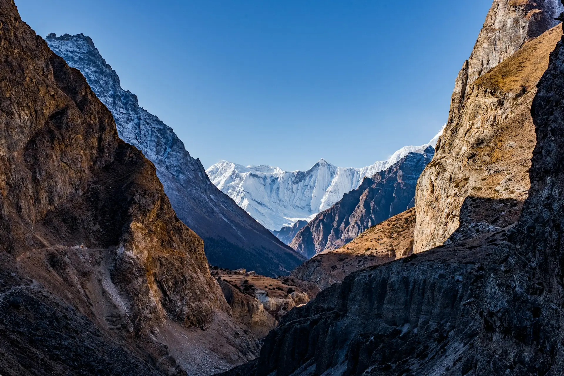
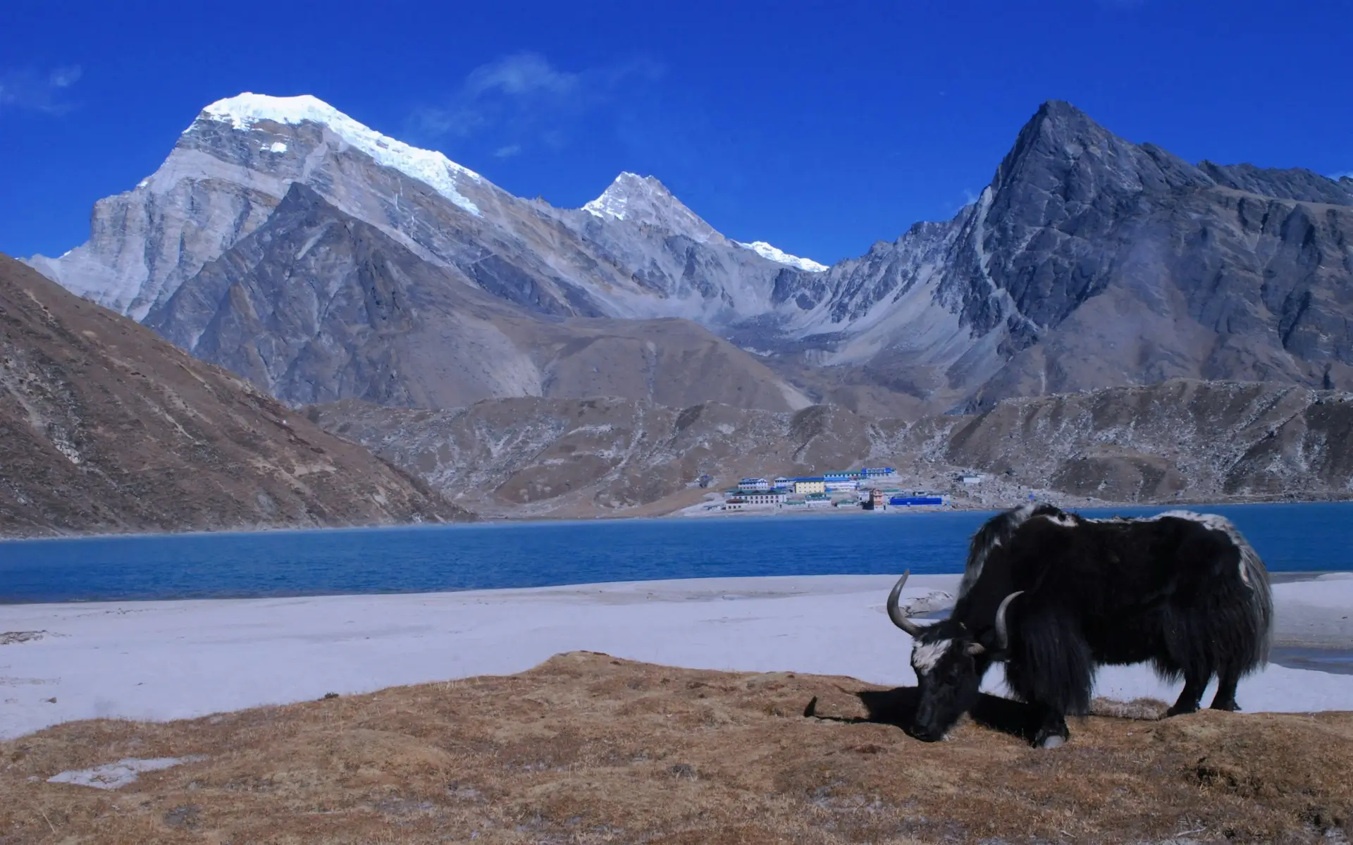
Quick answer: The Gokyo Lakes trek is a 12 to 14 day route in Nepal’s Everest region. It visits six turquoise glacial lakes between 4,700 m and 5,000 m, crosses the Ngozumpa Glacier, and climbs Gokyo Ri at 5,357 m. From that summit you see four of the world’s six highest mountains at once.
Most trekkers fly to Lukla and turn right toward Everest Base Camp. If you are torn between the two, our Gokyo Lakes vs Everest Base Camp comparison lays out the honest trade-offs. Turn left instead, and you get the quieter, and in my honest opinion, more beautiful half of the Khumbu. The Gokyo valley holds a chain of lakes so blue they look painted. Above them stands a small peak with the best mountain view in Nepal. So this guide covers the route, the money, the altitude, and the facts about these lakes that almost nobody online gets right.
Key Takeaways
- The Gokyo Lakes are the world’s highest freshwater lake system, a Ramsar site since 2007.
- Gokyo Ri (5,357 m) shows Everest, Lhotse, Makalu, and Cho Oyu together.
- The trek takes 12 to 14 days and costs roughly US$1,100 to $1,600 guided.
- The main lake, Gokyo Cho, is 43 m deep. The deepest, Thonak Cho, reaches 62.4 m.
- The lakes hold no fish at all, and there is a good scientific reason for that.
- You need the same two permits as Everest Base Camp, about US$45 in total.
Where is Gokyo Lake located?
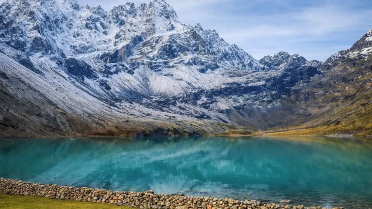
Gokyo Lake sits in Sagarmatha National Park, in the Solukhumbu district of north-eastern Nepal, at about 4,750 m. It lies in the Gokyo valley, west of the main Everest Base Camp trail, at the foot of Cho Oyu. Cho Oyu is the world’s sixth highest mountain at 8,188 m.
To place Gokyo Lake on a map of Nepal, look north-east of Kathmandu, close to the Tibetan border. The lakes feed the Dudh Koshi river, which eventually joins the Ganges system. So these small blue pools sit at the very top of one of Asia’s great river networks.
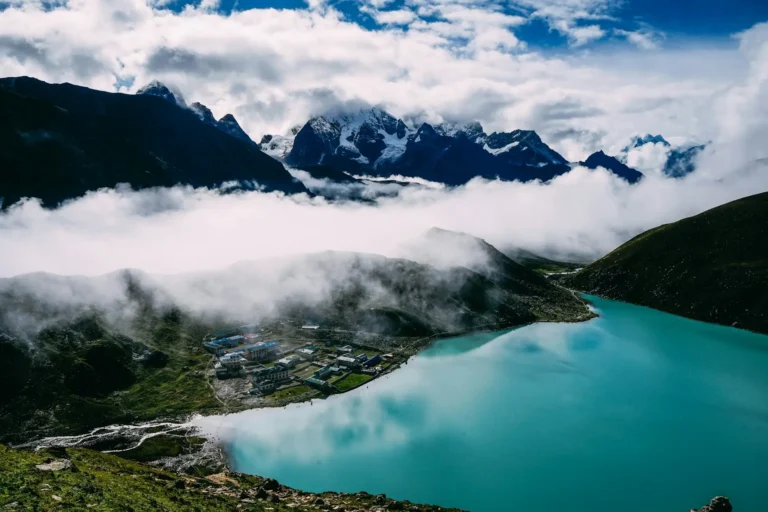
Meanwhile, the village of Gokyo stands on the eastern shore of the third and main lake. It is a tiny cluster of stone lodges, and it is the highest place most trekkers sleep on this route.
What are the Gokyo Lakes?
They are a chain of glacial lakes fed by snowmelt, and together they form the highest freshwater lake system on Earth. In September 2007 the lakes and their surrounding wetlands, some 7,770 hectares, were designated a Ramsar site of international importance.
In total, the system holds 19 lakes spread across 196.2 hectares, lying between 4,710 m and 4,950 m. Six of them are the main lakes that trekkers actually walk past. Here are the ones that matter on the trail.
| Lake | Local name | Notes |
|---|---|---|
| First lake | Longpongo | The lowest, passed on the way up |
| Second lake | Taboche Tsho | Vivid turquoise in clear light |
| Third lake | Gokyo Cho (Dudh Pokhari) | The main lake. Gokyo village sits on its shore |
| Fourth lake | Thonak Cho | The largest and deepest of them all |
| Fifth lake | Ngozumpa Tsho | Reached on a day walk, superb Everest views |
| Sixth lake | Gyazumba Tsho | Remote, rarely visited |
In practice, most trekkers see the first three. However, the walk up to the fourth and fifth lakes is one of the best half days in the Khumbu. Also, it costs you nothing but time.
How deep is Gokyo Lake?
Gokyo Cho, the main lake beside the village, is about 43 m deep and covers 42.9 hectares. The deepest of the group is Thonak Cho, the fourth lake, which reaches roughly 62.4 m. It is also the largest at about 65.07 hectares.
That is deeper than most people guess. From the shore the water looks shallow, because it is astonishingly clear. But the bottom drops away fast. So the colour changes from pale green to deep blue within a few metres of the edge.
Also, the water is cold enough to be dangerous. So swimming is a bad idea, and it disrespects a lake that local Sherpa and Hindu pilgrims both treat as sacred.
Are there fish in Gokyo Lake?
No. The Gokyo lakes hold no fish at all, and that is not an accident. The official Ramsar description records the wetland as devoid of fish. This is one of the most common questions about these lakes, and almost every trekking page online gets it wrong or skips it.
The reason is that the lakes are oligotrophic, which means extremely low in nutrients. Meltwater arrives cold, clear, and carrying almost no organic matter. So there is very little at the bottom of the food chain to support fish.
What does live here is smaller and stranger. For example, research on the Gokyo valley lakes has recorded 143 algal species from 80 genera. Notably, diatoms make up about two thirds of that community, a classic signature of nutrient-poor water. Scientists have also found macroinvertebrates from 22 families across 10 orders, mostly midge larvae and mayflies.
In short, the emptiness you sense standing there is real. That clarity is the whole point: nothing is growing in the water to cloud it. And that same sensitivity makes these lakes useful for science. A 2026 study even measured microplastics in the lake sediments, this far from any city.
How high is Gokyo Ri, and is it worth climbing?
Gokyo Ri stands at 5,357 m, and yes, it is worth every step. It is a steep walk, not a climb, and it rises directly behind Gokyo village. Most trekkers reach the top in two to three hours, then come down in about half that.
Above all, the view is the reason people choose this trek over the standard one. In fact, from the summit you can see four of the six highest mountains on Earth at the same time. Those are Everest at 8,849 m, Lhotse at 8,516 m, Makalu at 8,463 m, and Cho Oyu at 8,188 m. Below you, the Ngozumpa Glacier runs down the valley like a grey road. Ngozumpa is the largest glacier in Nepal.
So how does it compare with Kala Patthar, the classic Everest viewpoint? Honestly, Gokyo Ri gives the wider view, because you see the whole Everest massif with the lakes below. Our Kala Patthar guide covers the other side of that choice.
Go at first light. Because cloud builds through the morning here, and the mountains are sharpest just after sunrise.
How difficult is the Gokyo Lakes trek?
It grades 3 out of 5, Strenuous, on the Spade Himalaya Trek Difficulty Scale. The altitude is the challenge, not the terrain. There is no technical ground on the standard route. You walk on trails, and you sleep in lodges every night.
Here is our scale, so you can place this trek against others we run.
| Grade | Level | What it means | Example |
|---|---|---|---|
| 1 | Easy | Under 3,500 m, gentle days | Short valley walks |
| 2 | Moderate | To about 4,200 m, no high pass | Annapurna Base Camp |
| 3 | Strenuous | 5,000 to 5,550 m, good lodges | Gokyo Lakes, Everest Base Camp |
| 4 | Challenging | Remote, rough long days, simple lodges | Everest Three Passes |
| 5 | Expedition | Very remote, camping or several high passes | Upper Dolpo |
You walk about five to seven hours a day. The hardest single effort is the climb to Gokyo Ri, and the steep pull up from Namche early on. However, the real risk is height. At 5,357 m the air holds roughly half the oxygen of sea level. So pace and rest days matter far more than leg strength.
For the full picture on prevention and symptoms, read our altitude sickness guide. Our guides carry a pulse oximeter and check trekkers daily above Namche.
Is it harder than Everest Base Camp? Not really. Both top out around the same height, and both are graded 3. But Gokyo is quieter, and the trail up the Gokyo valley is gentler than the long stony march to Gorak Shep.
How long is the Gokyo Lakes trek?
Plan 12 to 14 days from Kathmandu, which means about 9 to 11 days of actual walking. Shorter versions exist, but they cut acclimatization, and that is the one thing you should never trim.
Here is the shape of a sensible 12 day route.
| Day | Route | Sleep at |
|---|---|---|
| 1 | Fly Kathmandu to Lukla, walk to Phakding | 2,610 m |
| 2 | Phakding to Namche Bazaar | 3,440 m |
| 3 | Acclimatization day in Namche | 3,440 m |
| 4 | Namche to Dole | 4,110 m |
| 5 | Dole to Machhermo | 4,470 m |
| 6 | Machhermo to Gokyo, past the first three lakes | 4,790 m |
| 7 | Gokyo Ri at dawn, then the fourth and fifth lakes | 4,790 m |
| 8 | Gokyo to Dole | 4,110 m |
| 9 | Dole to Namche | 3,440 m |
| 10 | Namche to Lukla | 2,846 m |
| 11 | Fly Lukla to Kathmandu | 1,400 m |
| 12 | Spare day for flight delays | Kathmandu |
That spare day is not padding. Lukla flights get delayed by cloud, so our Lukla airport guide explains why every good itinerary keeps a buffer.
Trekkers often ask about the Gokyo Lake to Namche Bazaar distance. In short, it is roughly 35 km on the trail. Most trekkers take two days going down, and three days coming up.
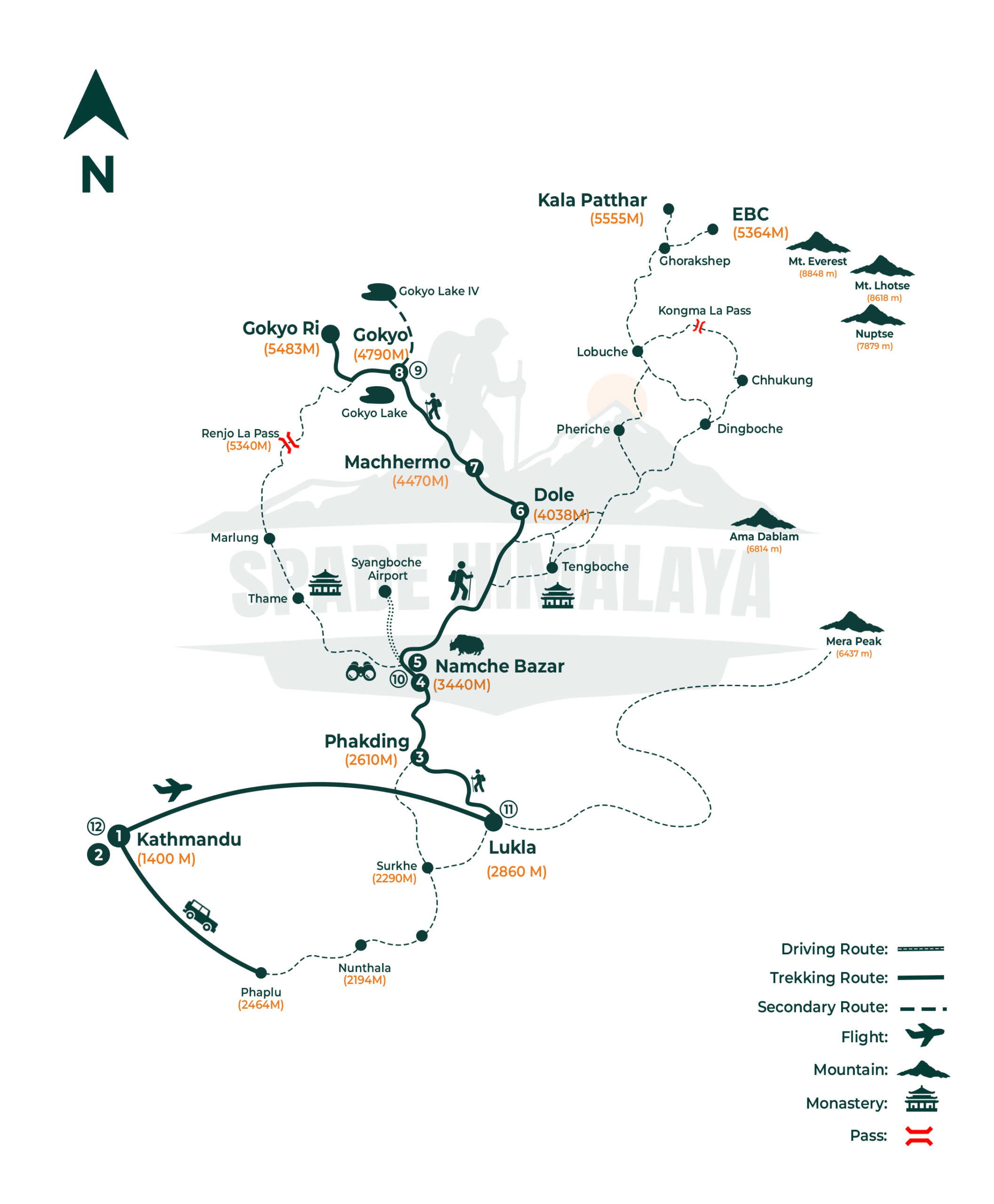
Our own Gokyo Lakes trek map. The route runs Lukla (2,846 m), Phakding (2,610 m), Namche Bazaar (3,440 m), Dole (4,038 m) and Machhermo (4,470 m) to Gokyo (4,790 m), with the viewpoint climb to Gokyo Ri at 5,357 m.
Can you combine Gokyo Lake and Everest Base Camp?
Yes, and it makes the best long trek in the Khumbu. You link the two valleys over the Cho La pass at 5,420 m. That version runs about 18 to 19 days, and it is the trip serious trekkers ask us for by name.
First, the route climbs the Gokyo valley. Then it crosses Cho La and joins the main trail at Dzongla for Everest Base Camp and Kala Patthar. So you get the lakes, the glacier, the pass, and base camp in one trip.
But be honest about the step up in difficulty. Because Cho La is a real high pass with ice near the top, it needs an early start and decent conditions. So this route grades 4, Challenging, not 3. It suits trekkers who have been at altitude before.
If you want the passes without base camp, the Everest Three Passes trek adds Renjo La and Kongma La as well, and our Three Passes route guide explains each crossing. Our Everest Base Camp versus Three Passes comparison sets out that decision.
How much does the Gokyo Lakes trek cost?
A guided Gokyo Lakes trek costs roughly US$1,100 to $1,600 per person in 2026. That covers your licensed guide, permits, lodges, meals on the trail, and the Lukla flights. The combined Gokyo and Everest Base Camp route costs more, because it runs a week longer.
Here is where the money goes.
| Item | Typical 2026 cost |
|---|---|
| Sagarmatha National Park permit | NPR 3,000 |
| Khumbu Pasang Lhamu Rural Municipality permit | NPR 3,000 |
| Kathmandu to Lukla flight, return | US$400 to $600 |
| Lodges and meals on the trail | US$30 to $45 per day |
| Licensed guide | US$25 to $35 per day |
| Porter | US$20 to $25 per day |
Notably, the Lukla flight is the single biggest line. So the Everest region costs more than Annapurna. For the wider regional picture, see our Everest Base Camp trek cost guide.
Tips are customary at the end. So budget roughly US$10 to $15 a day for a guide and US$7 to $10 for a porter. Alternatively, plan about 10% of the trip price shared among the crew.
What does the Gokyo Lake trek cost for Nepali trekkers?
Far less, mainly because the permits drop and there is no international airfare. Nepali citizens pay a small fraction of the foreign national park fee, and SAARC nationals pay a reduced rate too. Lodge and food prices on the trail are the same for everyone.
So a Nepali trekker organising things directly can complete this trek for well under half a foreign package price. We are happy to quote a domestic rate, so just ask.
What permits do you need for Gokyo?
Two, and they are the same permits as Everest Base Camp. First, the Sagarmatha National Park entry permit at NPR 3,000. Second, the Khumbu Pasang Lhamu Rural Municipality permit, also NPR 3,000. Together that is about US$45.
There is no TIMS card in the Everest region, because the local municipality permit replaced it. Both are paid in Nepalese rupees, and both are checked at gates on the trail. Our Everest permits guide explains where to buy each one.
Nepal also requires a licensed guide in national park areas. On a guided trip we arrange both permits for you.
When is the best time to trek to Gokyo?
Late September to November gives the clearest skies. March to May is the warm second season. October is the classic month, because the air is stable after the monsoon and the lakes reflect the peaks best.
Here are the temperatures our guides typically see, as Spade field-experience estimates.
| Season | Day (mid-trail) | Night (Gokyo, 4,790 m) | What to expect |
|---|---|---|---|
| Spring (Mar to May) | 8 to 15 C | -8 to -12 C | Warming days, some haze late in spring |
| Monsoon (Jun to Aug) | 12 to 18 C | -5 to -8 C | Cloud, rain, hidden peaks, delayed flights |
| Autumn (Sep to Nov) | 6 to 14 C | -10 to -18 C | The clearest skies of the year |
| Winter (Dec to Feb) | 2 to 8 C | -20 to -25 C | Empty trails, hard cold, some lodges shut |
A Gokyo Lakes trek in November is superb, and it is my own favourite time. Skies are sharp, crowds have thinned, and the lakes freeze at the edges into patterns worth the cold. However, nights are genuinely harsh, so bring a four-season sleeping bag.
In winter the higher lakes freeze over completely. Some lodges above Machhermo close, so check before planning a December or January trip. For the wider seasonal picture, see our Everest Base Camp weather guide.
Is the Gokyo Lakes trek worth it?
Yes, and especially if crowds put you off the standard route. The Gokyo valley carries a fraction of the traffic of the Everest Base Camp trail, and the scenery is more varied.
Consider what you actually get. First, you walk beside six turquoise lakes. Then you cross the largest glacier in Nepal, and stand on a summit with four eight-thousanders in one view. Meanwhile, on the classic route, base camp itself is a rocky moraine where you cannot even see Everest.
That last point surprises people, so it is worth saying plainly. Everest is not visible from Everest Base Camp. But it fills the sky from Gokyo Ri.
So who should choose the standard trek instead? Anyone whose real goal is standing at base camp itself, which is a genuine ambition and a fine one. Our Everest region trekking guide lays out every route in the Khumbu side by side.
FAQs
How high is Gokyo Lake?
The main lake, Gokyo Cho, sits at about 4,750 m. The wider system of 19 lakes lies between 4,710 m and 4,950 m, which makes it the highest freshwater lake system in the world.
How high is Gokyo Ri?
Gokyo Ri stands at 5,357 m. It rises directly above Gokyo village, and most trekkers climb it in two to three hours before dawn.
How long does it take to hike from Gokyo to Gokyo Ri?
Two to three hours up, and about one to one and a half hours down. It is steep and relentless, but there is no technical ground. Start in the dark to reach the top for sunrise.
Is November a good time for the Gokyo Lakes trek?
It is one of the best months. Skies are sharp after the monsoon, crowds have thinned, and the lakes freeze at their edges into patterns worth the cold. Nights are genuinely harsh by then, so bring a four-season sleeping bag.
Which is the deepest of the Gokyo lakes?
Thonak Cho, the fourth lake, at roughly 62.4 m. It is also the largest at about 65 hectares. The main lake beside Gokyo village, Gokyo Cho, is shallower at about 43 m.
How hard is the Cho La pass between Gokyo and Everest Base Camp?
It is the hardest part of the combined route. Cho La is a real high pass at 5,420 m with ice near the top, so it needs an early start and settled conditions. That crossing is why the combined trek grades 4, Challenging, rather than 3.
How much does it cost to trek to Gokyo Lake?
Roughly US$1,100 to $1,600 per person for a guided trek in 2026, including permits, guide, lodges, meals, and Lukla flights. Nepali and SAARC trekkers pay considerably less.
Can you trek to Gokyo Lake and Everest Base Camp together?
Yes. The two valleys link over the Cho La pass at 5,420 m, on a route of about 18 to 19 days. That version is harder, and it grades 4 because of the pass.
What is the distance from Gokyo Lake to Namche Bazaar?
About 35 km along the trail. Coming down usually takes two days. Going up takes three, because you gain height slowly to acclimatize.
Is Gokyo Ri better than Kala Patthar?
Both are superb. Gokyo Ri gives a wider view, with four eight-thousanders and the lakes below. Kala Patthar puts you closer to Everest itself. Many trekkers who do the Cho La route climb both.
Do you need a guide for the Gokyo Lakes trek?
Yes. Nepal requires a licensed guide in national park areas, and the Gokyo valley sits inside Sagarmatha National Park. A guide also manages your pace and altitude checks.
Is Gokyo Lake frozen in winter?
The higher lakes freeze fully in December, January, and February. The main lake ices over at the edges and often freezes across. Some lodges above Machhermo close for the season.
Accuracy note: the Ramsar designation, the 7,770 ha wetland area, the 19-lake system across 196.2 ha at 4,710 m to 4,950 m, and the record of the wetland being devoid of fish come from the Ramsar Sites Information Service listing for Gokyo and associated lakes (designated September 2007). Lake depths and areas (Gokyo Cho 43 m and 42.9 ha; Thonak Cho 62.4 m and 65.07 ha) and the algal and macroinvertebrate records are drawn from published limnological survey data for the Gokyo valley lakes. Permit fees follow the Nepal Tourism Board and match our Everest permits guide. Peak heights: Everest 8,849 m, Lhotse 8,516 m, Makalu 8,463 m, Cho Oyu 8,188 m. Temperature ranges are Spade field-experience estimates from our guides. Reviewed by Yubaraj Katel, government-licensed trekking guide (Licence No. 19827) with 10 years of experience leading treks in the Everest region.

Still Deciding?
Updated: 6 Jul, 2026
6 min
Everest Base Camp vs Three Passes: Which Trek Should You Choose?
Quick answer: Choose the Everest Base Camp Trek (14 days, strenuous) for the classic route and...
Updated: 6 Jul, 2026
9 min
Everest Base Camp Trek Cost in 2026: Full Breakdown
Quick answer: A guided Everest Base Camp Trek’s biggest single cost is the round-trip Lukla flight,...
Updated: 20 Jul, 2026
15 min
Everest Region Treks: Routes, Cost & Best Time (2026 Guide)
Quick answer: The Everest region, or Khumbu, is home to Everest Base Camp, the Gokyo Lakes,...